The British enjoy a reputation for talking obsessively about their weather. Maybe because it is always changing, due to the UK’s position on both the edge of the Atlantic and the Gulf Stream. Getting outside and enjoying one of the best hikes in the UK is a chance to see why it’s such a fascinating subject. On any day of the year, it’s never too wet, too dry, too hot or too cold to go for a walk somewhere in the UK.
With that in mind, here are 13 (a number sacred to the ancient Britons) of the country’s best walks. Pack your umbrella and your sunscreen, and get out into the great British outdoors.
The Gobbins, Belfast
The Gobbins, Belfast
This dramatic walkway located about an hour outside of Belfast, clinging to cliffs along the Antrim coast, is a great adventure. Tunnels, bridges, and walkways take you through the rock and out over the ocean for amazing views of nature in the raw.
A two-and-a-half-hour tour takes visitors along the base of the cliffs only a few yards above the waves in places. Guides explain the geology of these basalt rocks, as well as the plant and animal life that makes its home here.
The cliffs are home to some of Northern Ireland’s most important seabird colonies. You may see puffins on nests or cormorants diving for fish. Look out, too, for dolphins playing offshore.
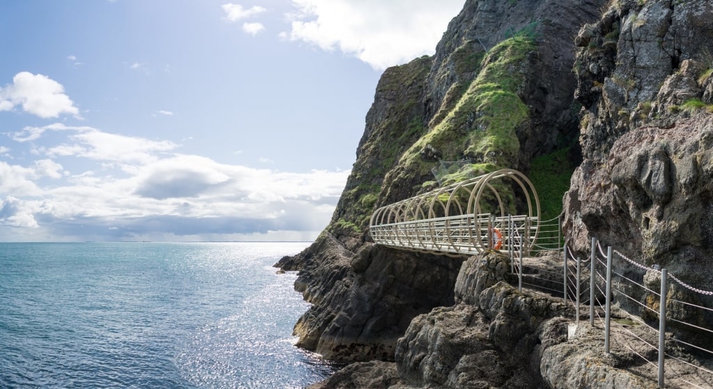
The Gobbins, Belfast
The walkway first opened in the 19th century as an attraction for visitors using Ireland’s new railway system. You will be glad to know it was comprehensively upgraded before reopening in 2016 with some spectacular improvements.
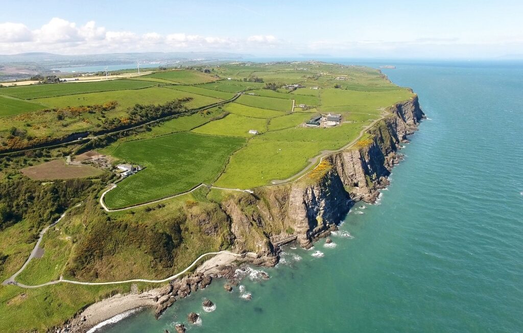
Causeway Coast Way, near Belfast
Causeway Coast Way, near Belfast
Named for the myth-shrouded Giant’s Causeway, this coastal path covers the 30 miles between the seaside resorts of Ballycastle and Portstewart. Most visitors, however, just walk the sections near the Causeway itself, taking in dramatic Dunluce Castle and the lovely town of Portballintrae.
In the other direction, towards Ballycastle, lies the giddy Carrick-a-Rede Rope Bridge once used by fishermen to reach their salmon nets.
Bushmills
The town of Bushmills, with its centuries-old whisky distillery, is a popular detour. Portrush, the resort just before Portstewart at the western end of the route, is well known as the home of the Royal Portrush Golf Club.
The courses at Ballycastle and Portstewart are both excellent as well, and extremely picturesque. Wild winds off the Atlantic will challenge any golfer on all of these links courses.
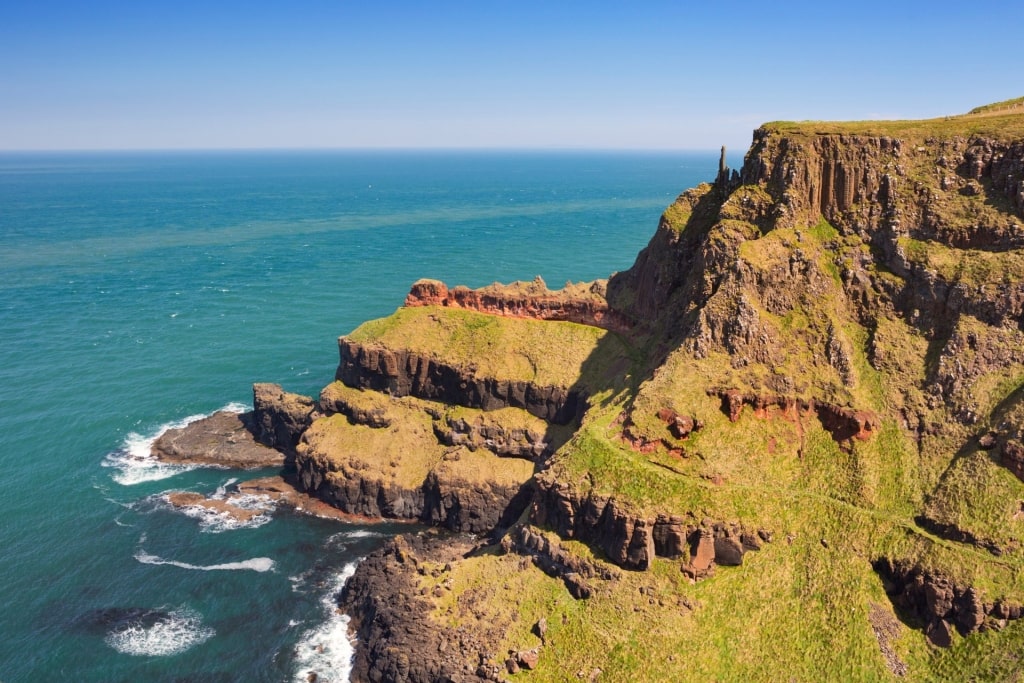
White Cliffs of Dover, Dover
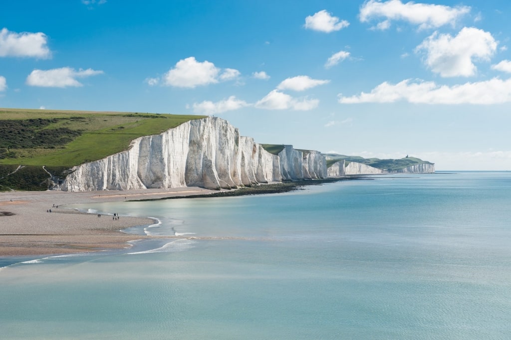
White Cliffs of Dover, Dover
The White Cliffs of Dover are famous in song and imagery as a symbol of England. Walking along their tops—which reach 350ft high in places—gives you great views of the green Kent landscape.
That vista stretches as far as the coast of France in clear weather, making this one of the best hikes in Europe. In the English Channel, you’ll see a busy mix of ferries, cargo ships, fishing boats, and yachts.
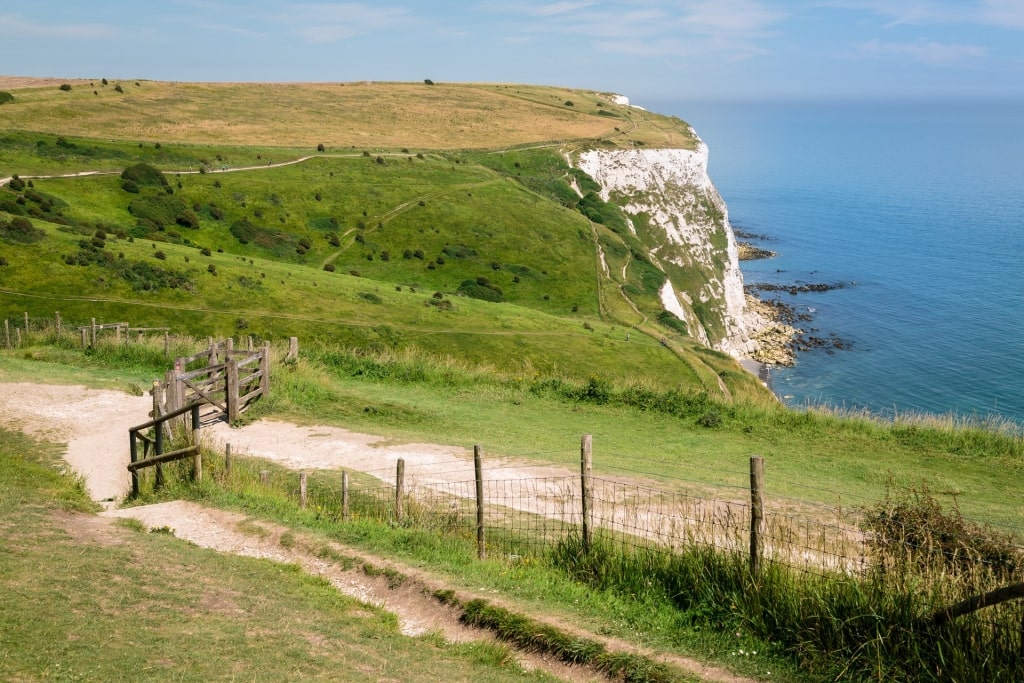
White Cliffs of Dover, Dover
Information cards from the visitor center will help you with identifying flora, butterflies or birds such as kittiwakes and peregrines. The many paths are easy enough to be wheelchair-friendly and stay well away from the crumbly chalk cliff edge.
On a sunny day, this is one of the most glorious parts of England. On a wet or windy day, you’ll have a great excuse to end your walk in a warm local pub or cozy tearoom. Either way, this is regarded as one of the best hikes in the UK.
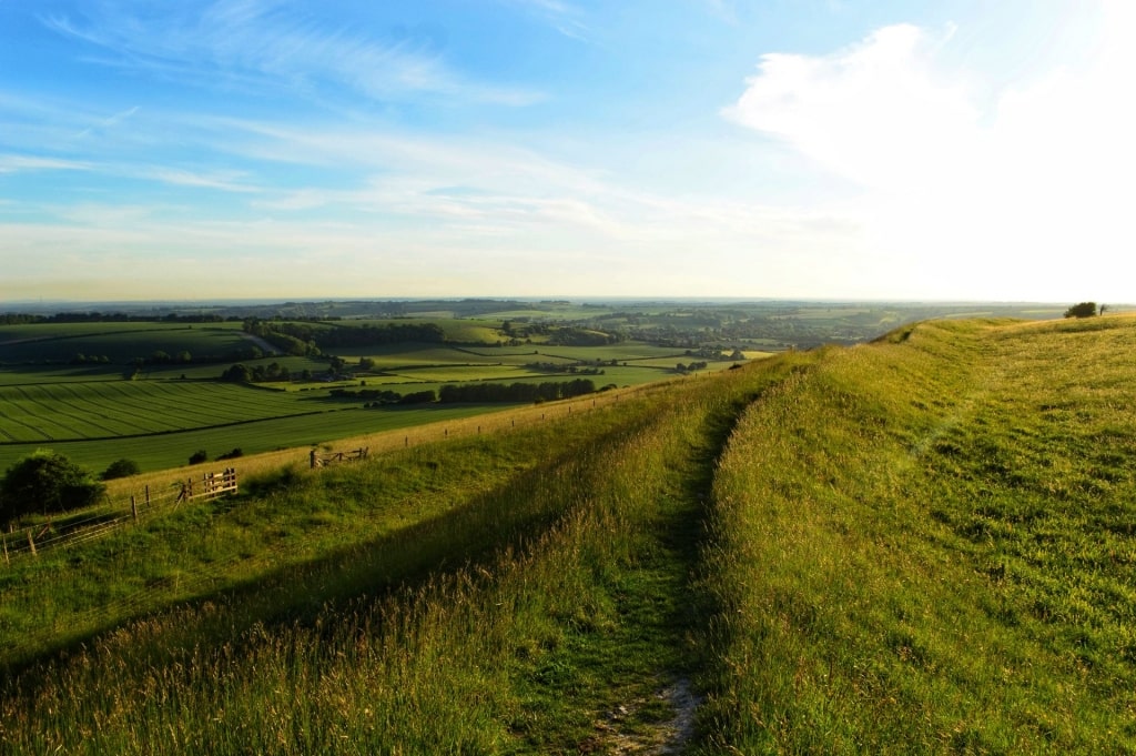
South Downs Way, near Southampton
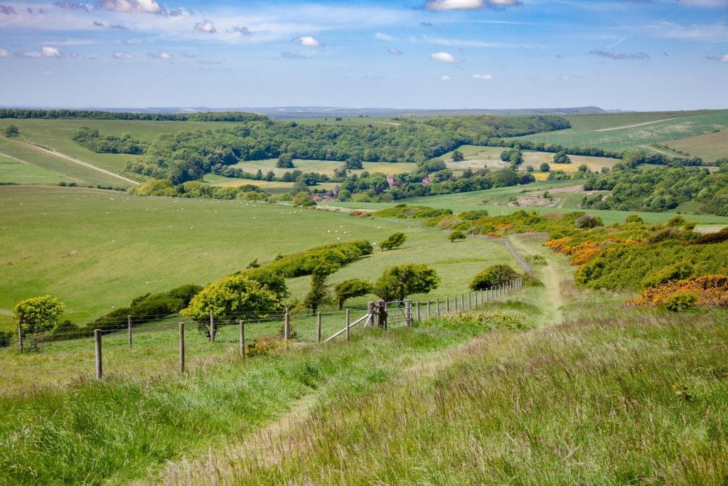
South Downs Way, near Southampton
This 100-mile National Trail near Southampton follows old routes used by cattle drovers across the chalk landscape of southern England. Whether you walk the whole route or just a section, it’s a perfect country escape.
The route is well signposted and the underlying chalk keeps it well drained, so it’s walkable all year round. Despite the easy-going across rolling hills, you can see as far as the English Channel.
Many areas of ancient woodland, chalk grassland and wildlife habitat are protected, adding variety to the plant and animal species you see.
Old Winchester Hill
One of these areas is Old Winchester Hill, which has long been popular for its views to the sea. Preserved as a National Nature Reserve, it holds an Iron Age hill fort and Bronze Age burial mounds.
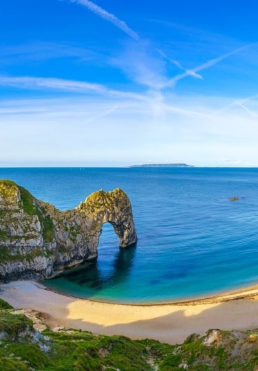
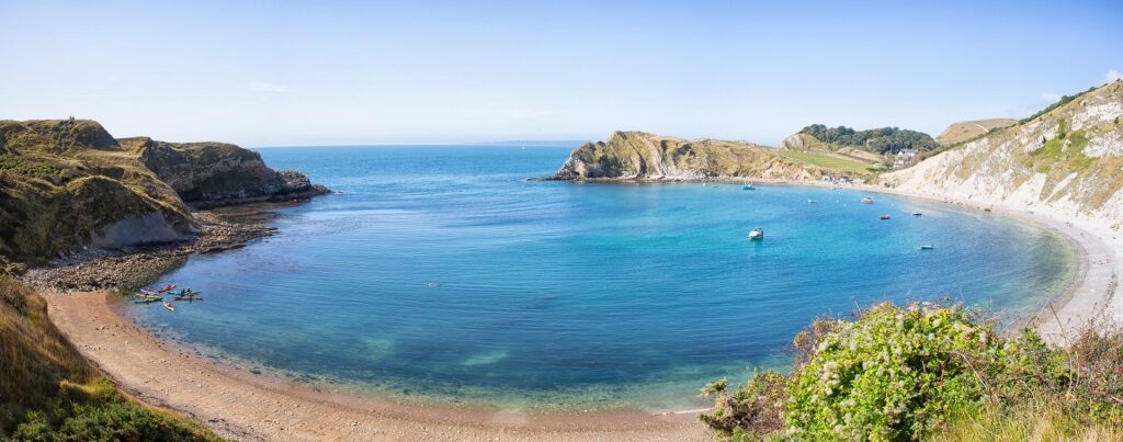
Jurassic Coast, near Portland, Dorset
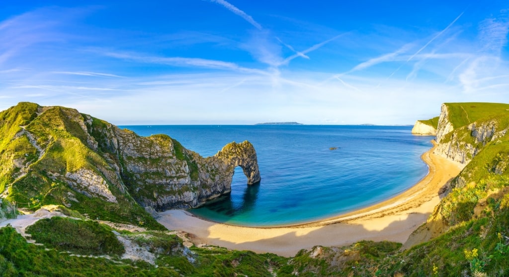
Jurassic Coast, near Portland, Dorset
This 100-mile stretch of coastline is England’s only natural World Heritage Site. As well as the geological importance, it’s also a truly beautiful wonder of nature.
Beginning at Orcombe Point in Exmouth, Devon, it follows the English Channel as far as Old Harry Rocks in Dorset. Towns and villages such as Exmouth, Sidmouth, Weymouth and Dorchester are attractions in their own right.
Lulworth Cove in Jurassic Coast, near Portland, Dorset
Spectacular Chesil Beach and Lulworth Cove are some of the UK’s best beaches, with the latter containing a fossil forest. Lyme Regis is rich in ammonites, with dozens of different rock strata.
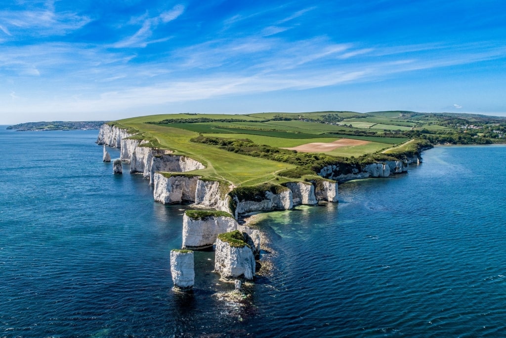
Old Harry Rocks in Jurassic Coast, near Portland, Dorset
Among the many walks on this coast, the four-mile hike to Old Harry Rocks stands out. The chalk cliffs end in this stack of rocks lashed by waves, a sight much loved by photographers.
Another popular stretch is from Lulworth Cove to Durdle Door, a limestone rock arch in the sea. A set of wooden steps will take you down to a pair of shingle beaches: Durdle Door and Man o’War Cove.
Stonehenge, near Portland, Dorset
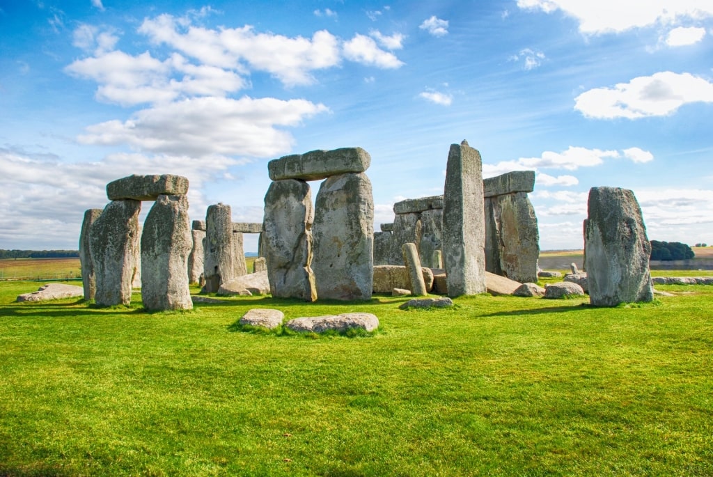
Stonehenge, near Portland, Dorset
This famous stone circle, one of Europe’s most famous landmarks, has stood here for 5,000 years, amid a glorious English chalkland setting. The landscape around has been restored to a natural setting and has several fantastic walks.
The “Secrets of Stonehenge” route takes in most of the site’s highlights. Starting at the National Trust visitor center, it’s an easy-to-follow three-mile trail.
As well as Stonehenge itself, you’ll see wildflowers, and butterflies in summer. Grazing sheep and cows help maintain the grasslands all year round.
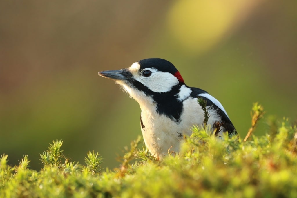
Green and great spotted woodpecker
Bronze Age burial mounds, patches of woodland and abundant birdlife all add variety to the walk. Green and great spotted woodpeckers are easier to hear than see, but you might be lucky.
There are plenty of information signs along the walk with guides to history and nature. Bring a picnic to make the most of the lovely views.
Stanage Edge, near Liverpool
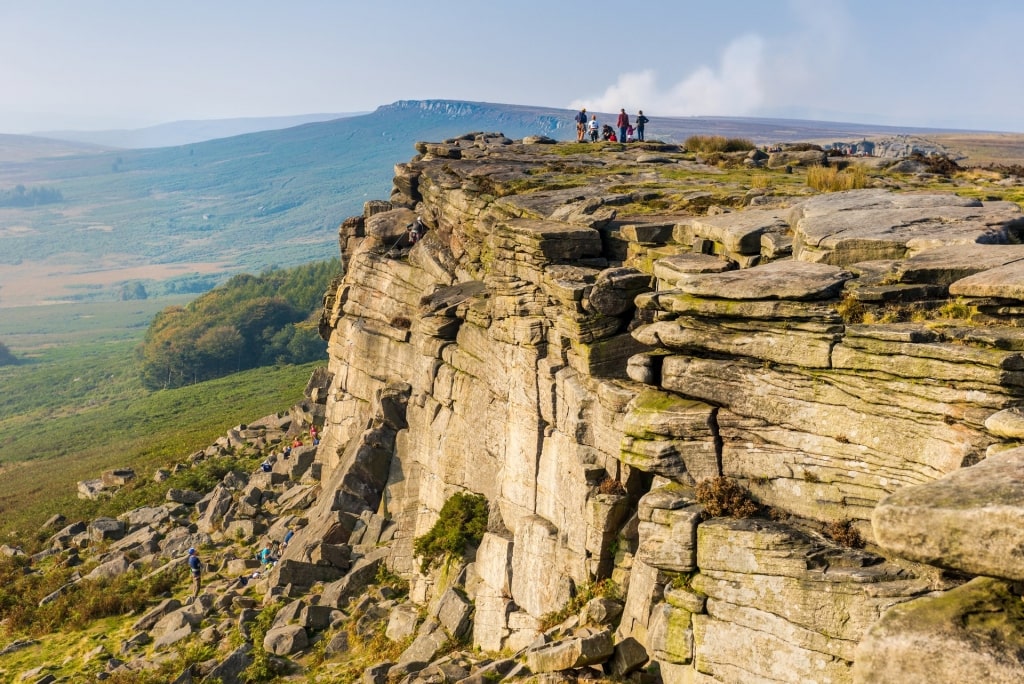
Stanage Edge, near Liverpool
This gentle four-mile walk is one of the best and easiest in England’s beautiful Peak District, and is under two hours’ drive from Liverpool. As popular with climbers as it is with hikers, the sheer inland cliff overlooks moorland filled with grouse.
Don’t let the idea of a cliff put you off. The clear path on top keeps well away from any vertigo-inducing edges.
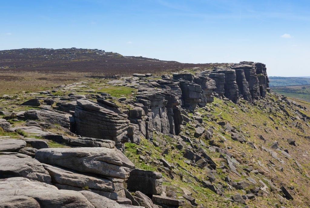
Stanage Edge, near Liverpool
The rocks are a tough gritstone that make climbing hard on the hands. But they also make great millstones and you may see broken ones abandoned close to where they were once quarried.
The moors, valleys and mountains around change their mood with the weather. As clouds obscure and cover the sun, the light darkens and brightens the many colors on show.
This atmospheric landscape was an inspiration for writer Charlotte Brontë. Some of the views may look familiar to you from TV and film adaptations of her work.
Scafell Pike, Lake District, near Liverpool
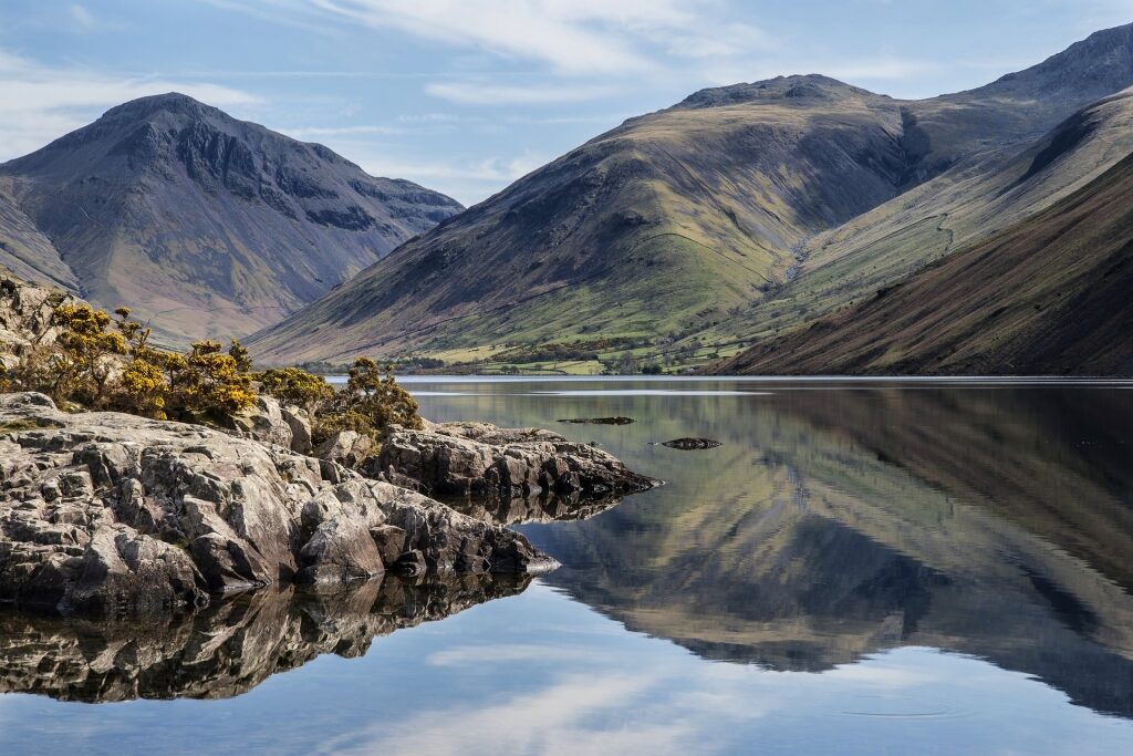
Scafell Pike, Lake District, near Liverpool
This challenging walk, one of the best hikes in the UK, takes at least five or six hours (round trip) in good weather. The reward is a spectacular view from the top of England’s highest mountain.
The two-hour drive from Liverpool is an adventure in itself, once you’re inside the Lake District National Park, an area of bucolic lowlands and lakes overlooked by brooding mountains.
Start from the National Trust car park at Wasdale Head for the shortest route to the top. There are no signposts, so a map is a good supplement to your phone GPS.
The English Ordnance Survey maps are excellent and also make for a good souvenir. On a good summer day, there will be plenty of other people around to help and advise you.
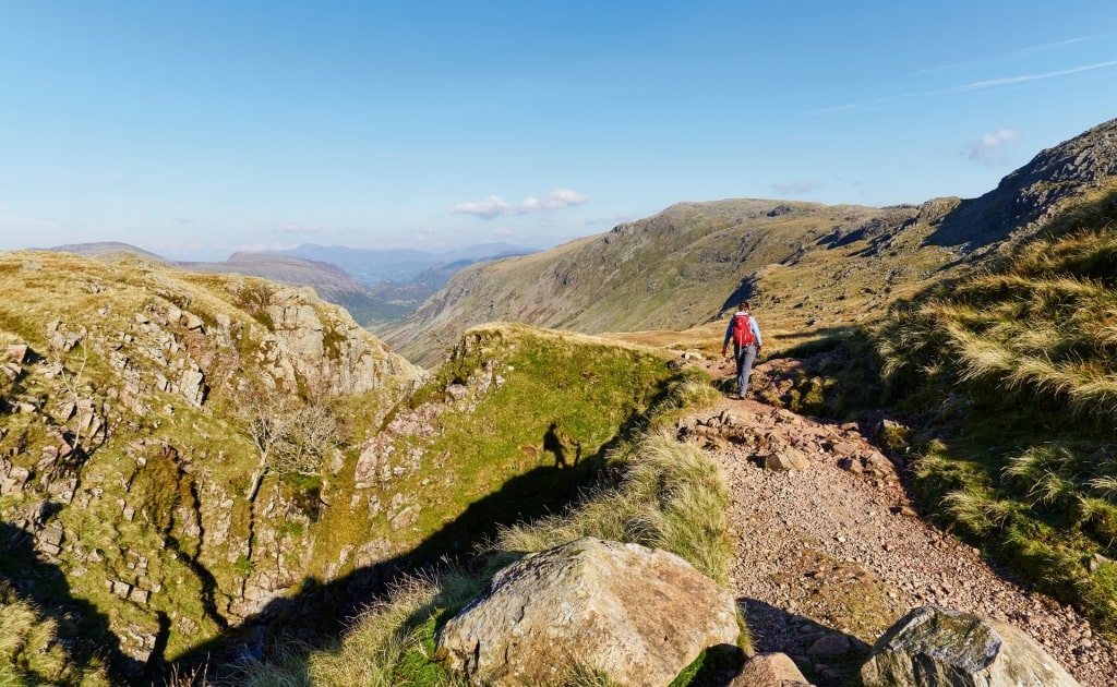
Scafell Pike, Lake District, near Liverpool
If the weather is bad, unless you are an experienced walker, wait for a clearer day when the view will also be better. Even on a summer’s day, come prepared for rain and the windchill at 3,208 ft.
Wear good boots, pack food and drink, and carry a torch and emergency whistle. Knowing you’re sensibly prepared will ensure you enjoy this great experience.
Read: 22 Best Lakes in Europe
Snowdonia National Park, near Liverpool
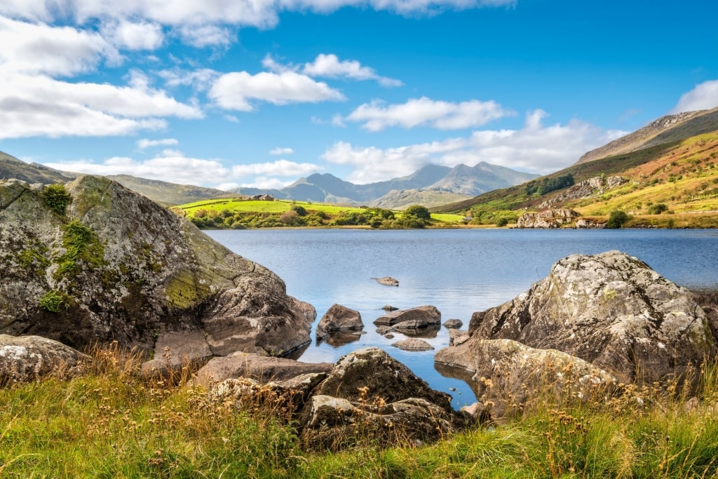
Snowdonia National Park, near Liverpool
Snowdon is the highest mountain in Wales and stands in a park full of lakes, rivers and even beaches. It’s an area rich in history, where more than half the population speak the Welsh language.
The beauty of Snowdonia has been celebrated in song and poetry for centuries. Explore it on footpaths that cater to any level of fitness or age.
Llanberis Path
Take the nine-mile Llanberis Path to the 3,560-ft top of Snowdon (“Yr Wyddfa” in Welsh), or amble around the Iron Age hillfort of Craig y Ddinas. Both reward you with lovely views of the sea and mountains.
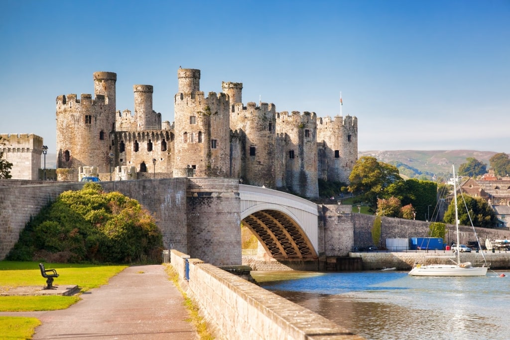
Conwy Castle
Harlech, Caernarfon and Conwy are among the finest of the many castles in Snowdonia. With 21 towers, Conwy is one of the most complete medieval walled towns in Europe and almost a mile around.
Wales Coastal Path, near Liverpool
Wales Coastal Path, near Liverpool
The Wales Coastal Path travels for over 850 miles around the country’s entire coastline. From the English city of Chester at the northern end, south to the town of Chepstow, it takes in everything from lonely beaches to historic castles.
Beautiful sunsets are guaranteed as you look west over the Irish Sea. Colonies of puffins, as well as choughs, shearwaters, buzzards, and peregrines will delight any walkers.
To learn more, the Ynys Gybi (Holy Island) in Anglesey, under two hours’ drive from Liverpool, is a must-see. Here, the South Stack RSPB Reserve will bring your walk close to razorbills and guillemots.
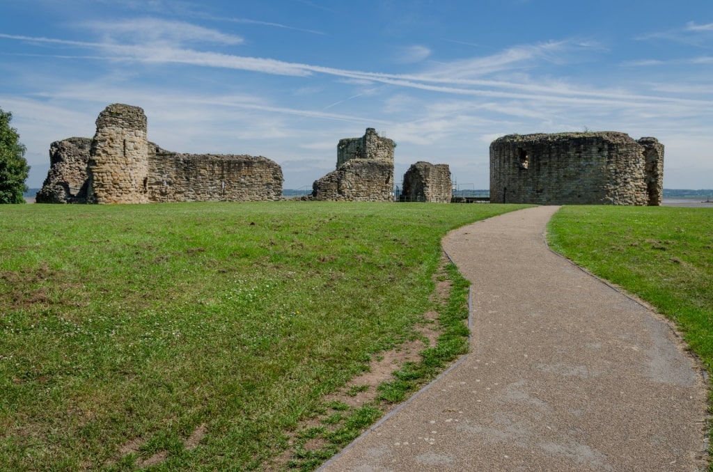
Flint Castle
If history is of more interest, try the six-mile trail along the Dee Estuary from Flint Castle to Basingwerk Abbey. Flint dates to the 13th century and was the first castle built in Wales by the English.
John Muir Way, near Glasgow
John Muir Way, near Glasgow
Named after the founder of America’s National Parks, this 133-mile route crosses central Scotland. Usually tackled from west to east, with the prevailing southwesterly wind at your back, it ends at Muir’s birthplace in Dunbar.
Roman remains, castles, and other historic buildings can be discovered along the way. Canals, rivers, and bridges add even more beauty.
With good access to public transport or taxis, the route is often explored in stages. There are also plenty of accommodation options.
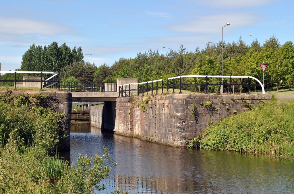
Forth and Clyde Canal
From Glasgow, the 13-mile Kilsyth to Falkirk section following the Forth and Clyde Canal is easy to reach. Once a busy shipping link between both coasts, this is now a place for fishing, walking, and quiet contemplation.
Both cyclists and hikers can enjoy the route, with the cycleways offering a more gentle option for walking. Signage is easy to follow in any direction.
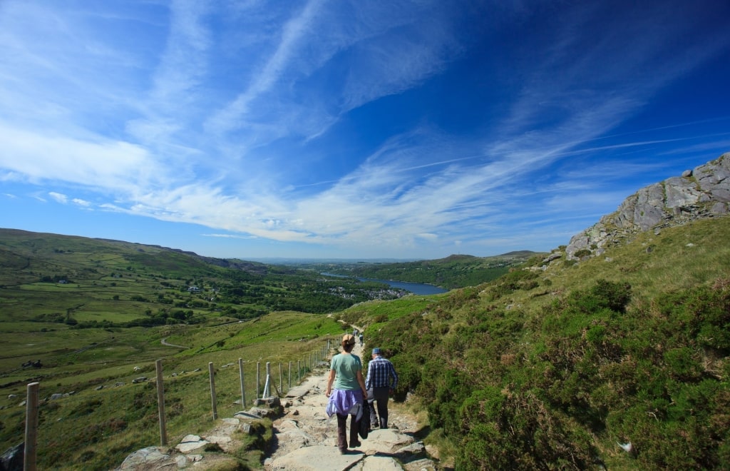
West Highland Way, near Glasgow
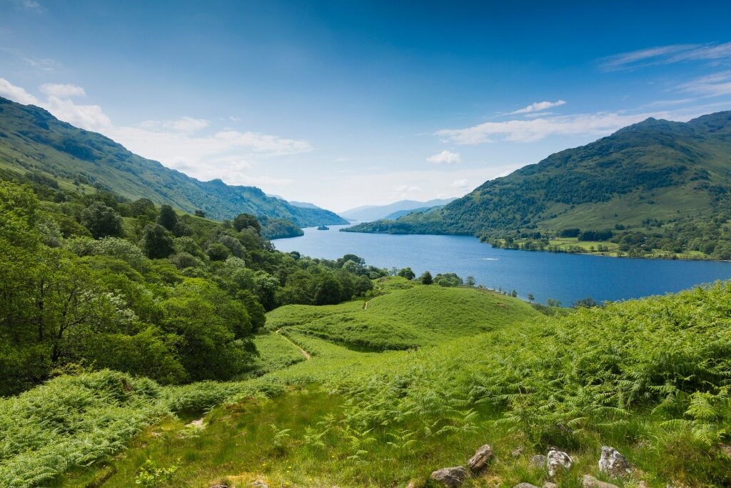
West Highland Way, near Glasgow
The West Highland Way goes north from Milngavie, just outside Glasgow, to Fort William. That 96 miles encompasses some of the most beautiful scenery that Scotland is known for, a land of rugged mountains, heather-covered hillsides, and tranquil sea lochs.
Most walkers start at the southern end, allowing time to build fitness for the mountainous north. It takes about a week, although the record for runners is an incredible 14 hours.
You can take a train from Glasgow to the start at Milngavie and just tackle a short section of the walk. This first 12-mile section to Drymen ends on the shores of Loch Lomond.
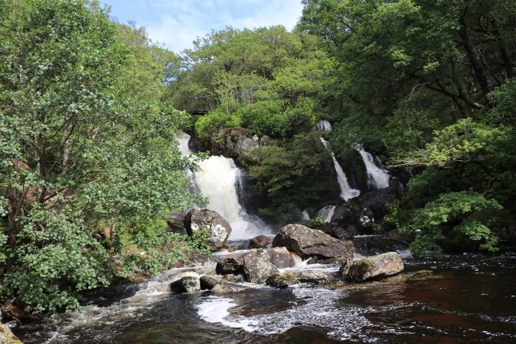
Inversnaid Waterfall
At the northern end of the loch, the third-day section from Rowardennan to Inverarnan is a spectacular 14 miles. Wild mountains, Inversnaid waterfall and a wee dram at the Drovers Inn are all highlights.
June to August can be a problem with midges, so come prepared with bug spray and long sleeves. They don’t carry diseases but can be very annoying.
The Great Glen Way, Inverness
The Caledonian Canal was built in the 19th century to take steamships from Inverness, in the east, to Fort William on Scotland’s western coastline. Its route is now followed by the Great Glen Way, an 80-mile walk.
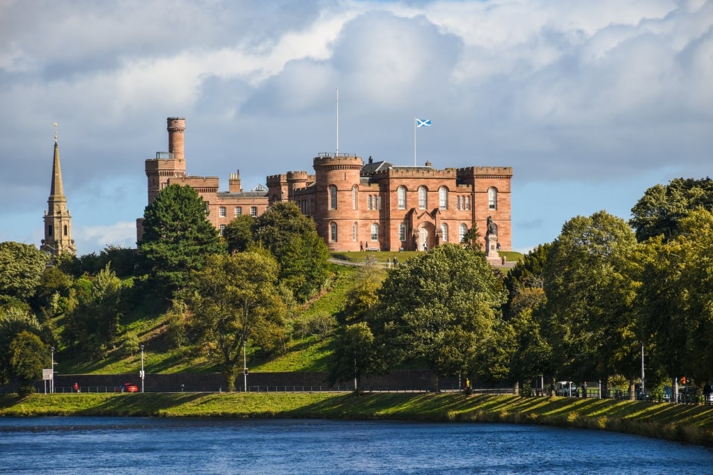
Inverness Castle
Inverness Castle marks the eastern end of the path, so you can actually start straight walking right at Inverness Harbour. However, the city’s Whin Park is a great place to follow a loop walk along the canal to the docks at Dochgarroch.
This route is seven and a half miles long and, this being a canal towpath, is almost completely flat. Leave some time to explore Whin Park itself, with its lovely woodlands and the Ness Islands reached by beautiful Victorian footbridges.
At the lock, you can cross over to come back on the other side of the River Ness. And don’t worry: the water here is much too shallow for the Loch Ness Monster to swim in.
Inspired to start walking some of Britain and Northern Ireland’s amazing landscapes? Browse our cruises to the British Isles that call at some of the UK’s most exciting ports.

