
From the wetter España Verde of the north to the balmy Mediterranean, Spain has a rich choice of landscapes. Hiking in Spain is a great way to see them, from coastal paths to the high peaks of the Sierra Nevada.
In Spain’s rural areas, walking—or mule train—was once the only way to move from village to village. The modern world has brought a network of high-speed roads, but those ancient paths remain to be enjoyed.
Many are now national long-distance “Gran Recorrido” GR walking routes. Few visitors have the time for the entire distances involved, but their red and white markers are useful guides for shorter walks.
Here are ten of the best places to hike in Spain.
Benimussa, Ibiza
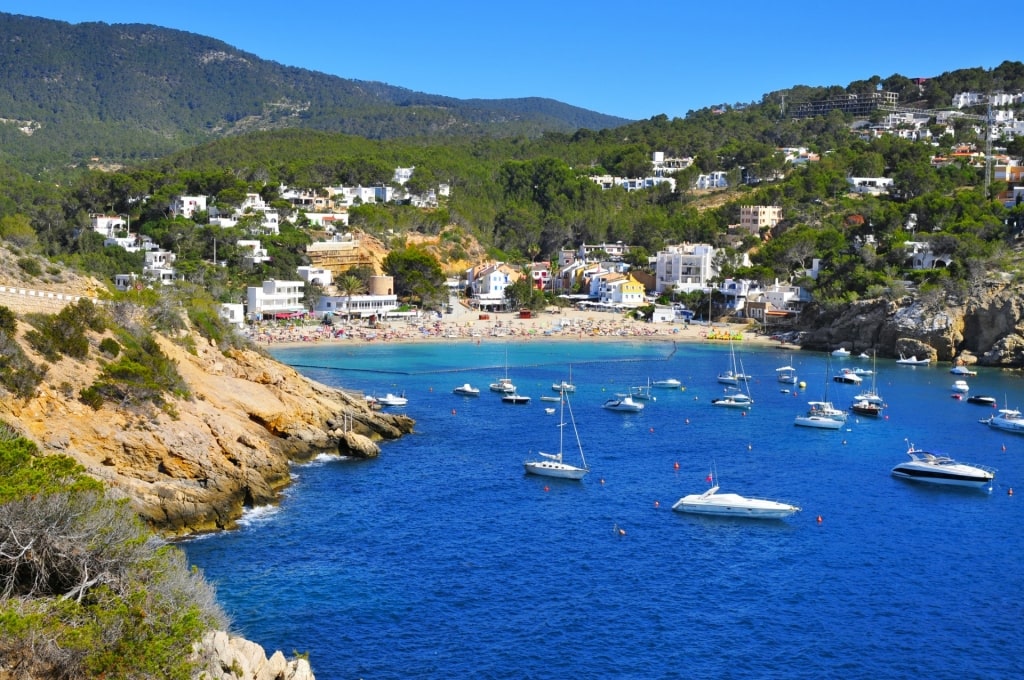
Sant Josef, Ibiza
Only 20 minutes from Ibiza Town, Sant Josef is the heart of a quiet agricultural area that feels very far away indeed from the busy capital. The Benimussa area seems to have changed little for centuries.
Small farmhouses, many lived in by the same family for generations, are scattered across farmland carved up by stone walls. Olive, almond, and fig trees cast shelter across terraces full of birdlife.
This wide valley is the start of the Camino de Benimussa, which crosses the interior of the island. It’s the spine of a series of walking paths once used by villagers.
Sa Talaiassa, Ibiza
Although also popular with cyclists, the area is not all flat, however. Southwest of Sant Josef is the 1,500-foot peak of Sa Talaiassa (“Watchtower”), the highest point on Ibiza.
As rural life declines, some areas have been taken back by nature. That leaves some hiking trails overgrown and markers covered by vegetation, so you’ll find a map or walking app essential.
Benimussa is at its best in spring and fall in Spain, which is also when birdwatchers most enjoy the area. In the summer heat, stick to shorter walks and always bring plenty of water.
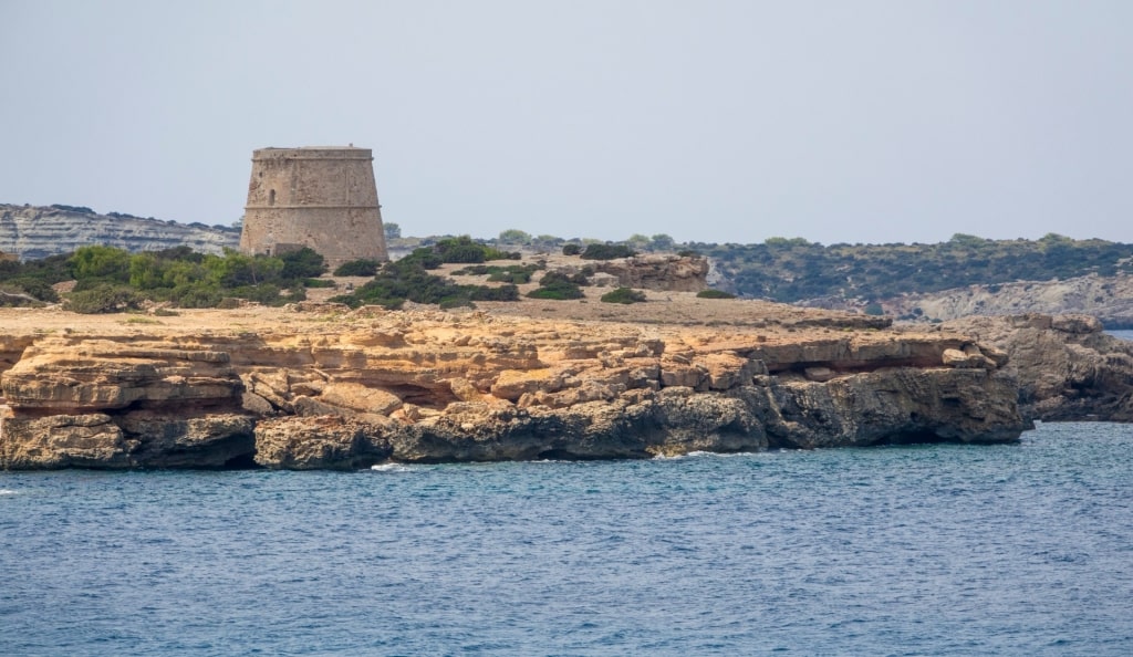
Monte Roldán, Cartagena

Monte Roldán, Cartagena
Murcia has some of the most underrated hiking in Spain. Whether it’s fishermen’s paths along the coast or tracks connecting mountain villages, you have plenty of possibilities for a great experience.
Along the coast, the clear blue sea tempts you for a dip to cool down, while the dense pine forests inland provide their own shade from the hot sun.

Abarán
For a taste of rural Murcia, the Waterwheel Route from Abarán takes in four traditional waterwheels. Still used to irrigate fruit orchards, they include Europe’s largest functioning waterwheel.

Monte Roldán, Cartagena
They are part of a system of acequias, irrigation channels that date back to Moorish times. The short walk connecting them near the Segura River is a journey back through a fascinating history.
Closer to Cartagena itself, Monte Roldán has a great two-and-a-half-mile walk through old military fortifications. The spectacular views over the sea from Mirador de Roldán stretch for many miles further, taking in the Bay of Cartagena and Tiñoso Cape.
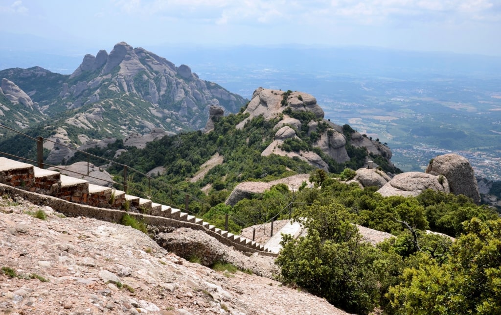
Montserrat, Barcelona
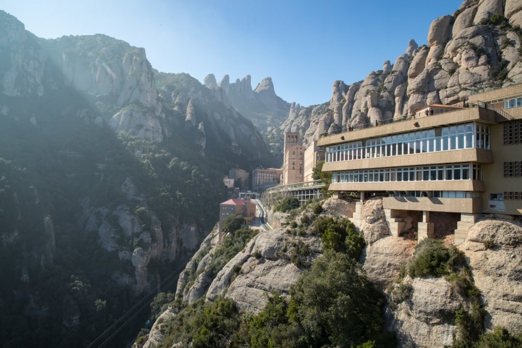
Montserrat, Barcelona
The Montserrat (“Serrated”) mountains are the most popular day trip from Barcelona. Beautiful in themselves, they also house the dramatic Monastery of Montserrat.
While most tours to the monastery take you to the top, you can also hike up the mountain. That’s an experience to take you back to the way pilgrims originally first saw the monastery.
Montserrat, Barcelona
The path starts near the rack railway which can take you back down the mountain a lot less effortlessly. The dirt trail is marked with the usual Spanish hiking markers of red and white stripes.
It is about an hour to teach the top, depending on how many times you stop to take in the view. It’s a steady climb, with steps to help out in steeper sections.
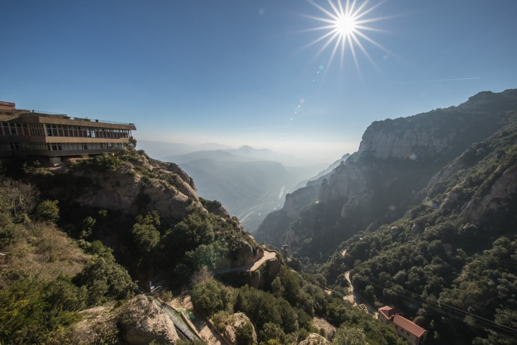
Montserrat, Barcelona
For more challenging walks, start at the top and explore the mountains. A popular route with Spanish hikers is the seven-mile loop to the summit of Sant Jeroni.
There are a number of other trails of varying lengths, such as the walk from the monastery to Santa Cova. Most are well documented on hiking apps, and there are usually plenty of other hikers to point out the way.
Sierra de Tramuntana Mountains, Palma de Mallorca
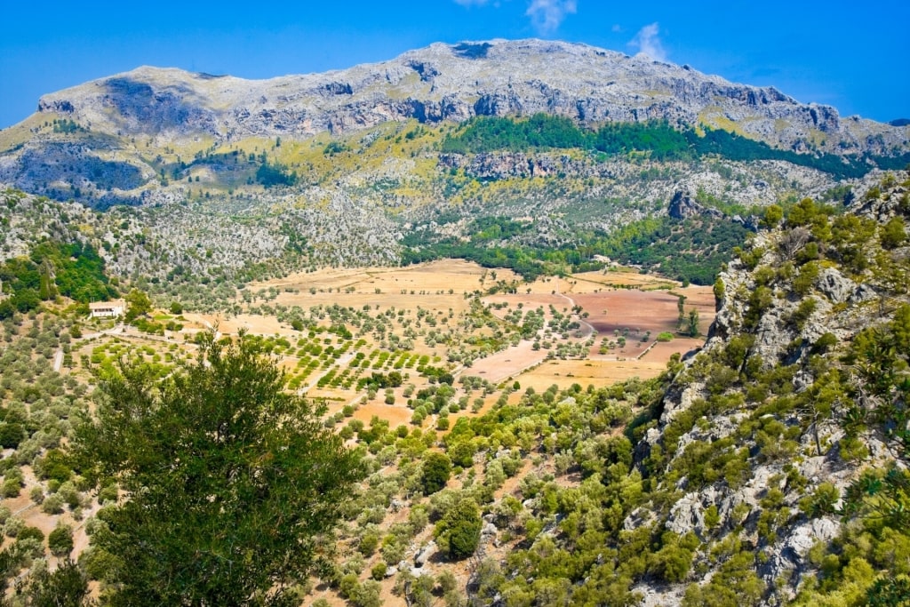
Sierra de Tramuntana Mountains, Palma de Mallorca
Hiking is a great way to explore the dramatic landscapes of the interior of Mallorca. The rocky gorges, fertile farmland, and quiet villages are a wonderful contrast to the white sands—and busy beach life—the island is better known for.
The Serra de Tramuntana mountain range runs across the northwest for more than 50 miles, with a dozen peaks over 3,000 ft. It’s a Unesco World Heritage Site, rich in nature and with picturesque dry-stone walls.
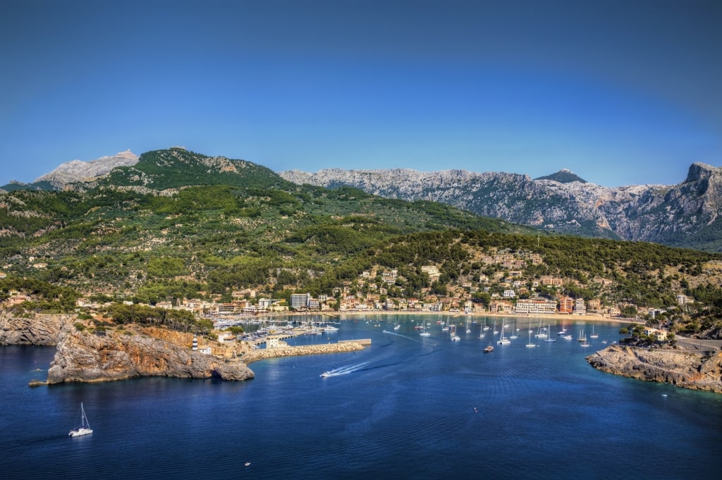
Sóller
The best base for exploring the range is the lovely town of Sóller. It’s just over 30 minutes by car or bus from the capital, Palma, and slightly longer by the very scenic railway route.
Sóller is a hiking center with a multitude of routes of differing length and difficulty. Stroll along the coast to another small village, or head off into the mountains for a stiffer challenge.
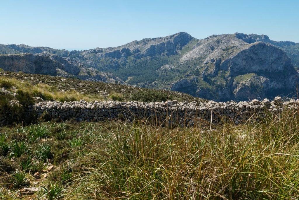
Dry Stone Route in Sierra de Tramuntana Mountains, Palma de Mallorca
The ultimate route in the Serra de Tramuntana is the epic 85-mile GR221 “Dry Stone Route”. Normally done in eight stages, it gets its name from the cobbled paths lined with rugged walls it follows through ancient terraces.
From Sóller, explore signposted parts of the GR221 for a taste of that experience. The six-mile walk between Sóller and Deia, for example, has sea views, and picturesque olive groves.
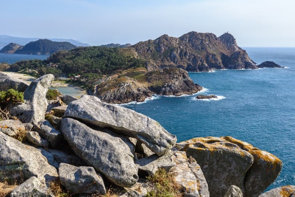
Cies Islands, Vigo
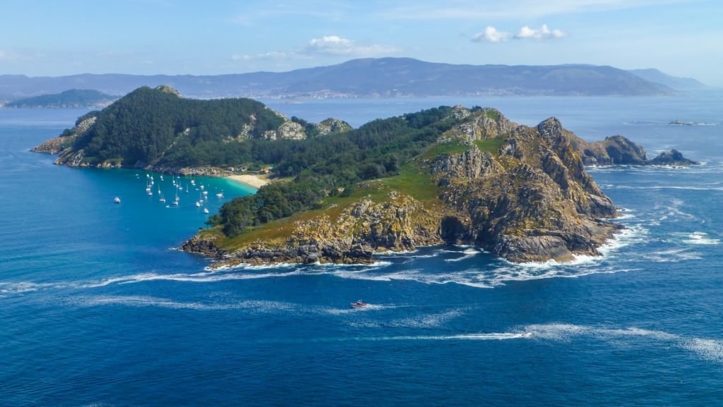
Cies Islands, Vigo
From Vigo, many walkers will find themselves drawn to the pilgrimage route to Santiago de Compostela. This is a six-day walk with sweeping views along the coast.
Walking a short section towards Santiago, or away from it along the Atlantic Coast to Baiona, is an option for more casual hikers. Even better may be to take the 45-minute ferry trip to the Cíes Islands.
Cies Islands, Vigo
These three islands in the Vigo Estuary form part of Galicia’s Atlantic Islands National Park. Being home to some of the best beaches in Spain, they are popular with local visitors.
You will need a permit, as well as a ferry ticket, to visit—an effort to control numbers. Apply early to be sure of a place.
It’s worth it to visit somewhere the Romans named “Islands Of The Gods”. The three islands are a paradise of beaches, clear waters, and rich flora and fauna.
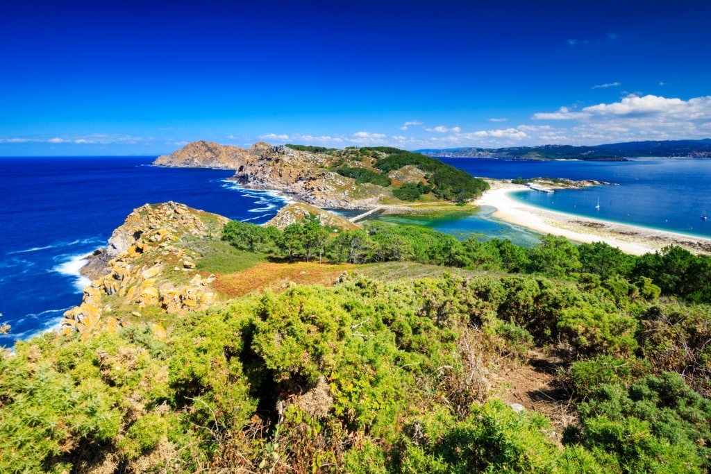
Alto del Príncipe in Cies Islands, Vigo
Take an hour-long walk along the Alto del Príncipe to Agudo Mountain for an overview. The seabird sanctuary is a bonus on this route, which takes in cliffs, and sand dunes.
Or follow the four-mile Fora Lighthouse Route across to the island of O Faro. You’ll pass the white sands of Nosa Señora Beach and can take in views out to the third island of Saint Martiño.
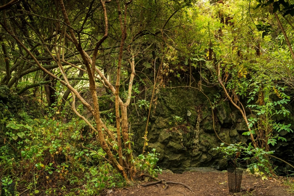
Doramas Natural Park, Gran Canaria
Doramas Natural Park, Gran Canaria
Gran Canaria doesn’t enjoy the same reputation for hiking as Tenerife, despite having much the same variety of terrain. Sign-posted walks criss-cross the island, taking you through some spectacular scenery.
That scenery is as varied as it is beautiful, from palm trees to forests, and from rock gorges to wide ocean views. Year-round good weather adds to the appeal for hikers, or indeed anyone.
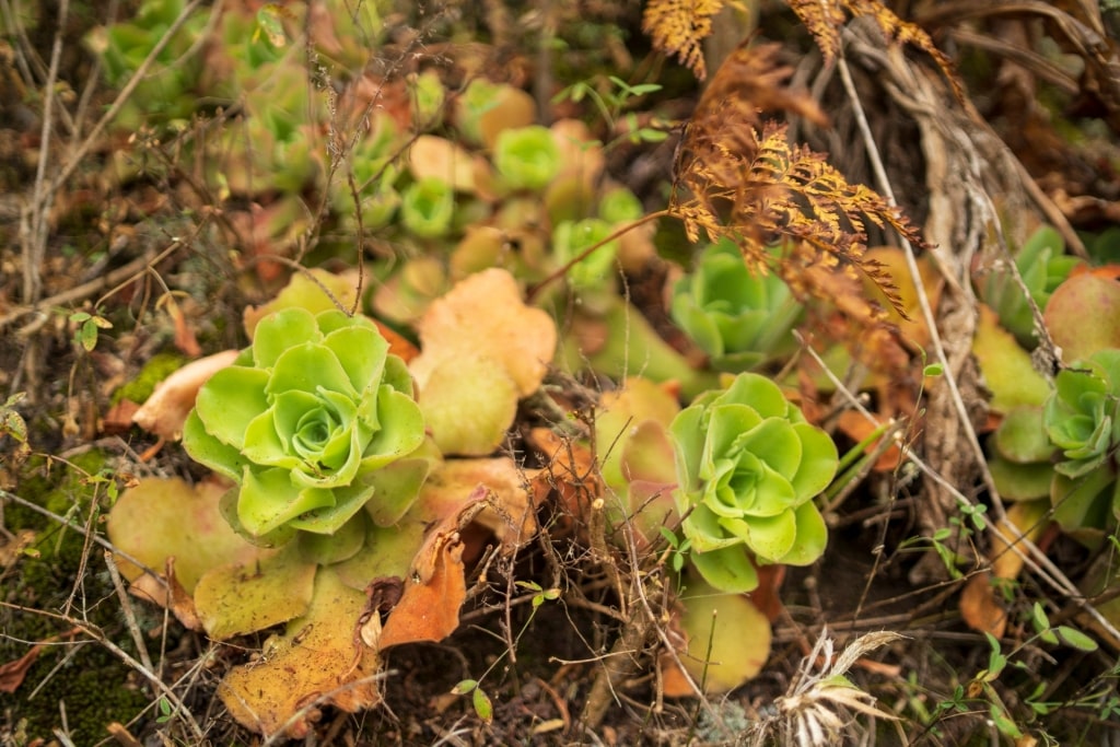
Doramas Natural Park, Gran Canaria
Doramas Rural Park is a gem of northern Gran Canaria, covering nearly 15 square miles. It encompasses several small villages, wide fertile valleys and steep wooded ravines.
One of those ravines or barrancos is protected as part of the Barranco Oscuro Natural Reserve. It has a wide variety of natural flora, which bloom spectacularly in spring, and rich birdlife.
Los Tiles de Moya in Doramas Natural Park, Gran Canaria
Another area not to miss is Los Tiles de Moya, which protects ancient laurel trees. Once covering the island, but threatened by the timber trade, this outpost was saved by the efforts of writer Miguel de Unamuno.
The Interpretation Center is the best place to start the short walk through this reserve. You’ll learn all about the history of the area and the network of acequias (canals) and water tanks that irrigated it.
Teide National Park, Tenerife
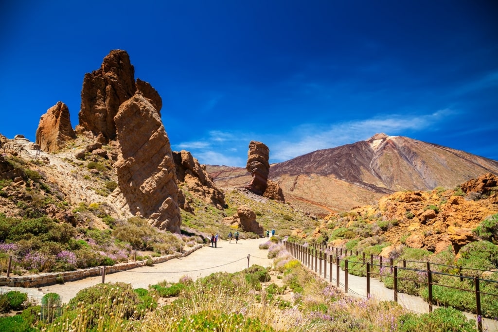
Teide National Park, Tenerife
The most popular national park in Spain is dominated by Mount Teide, the highest mountain of Spain. Its jagged volcanic landscapes have been used to test vehicles for exploring Mars.
While many hikers come to conquer the 12,188-foot Mount Teide, there are many quieter, more interesting walks. The short Roques de Garcia loop, for example, offers rocky landscapes reminiscent of Utah’s Monument Valley right beside the main car park.
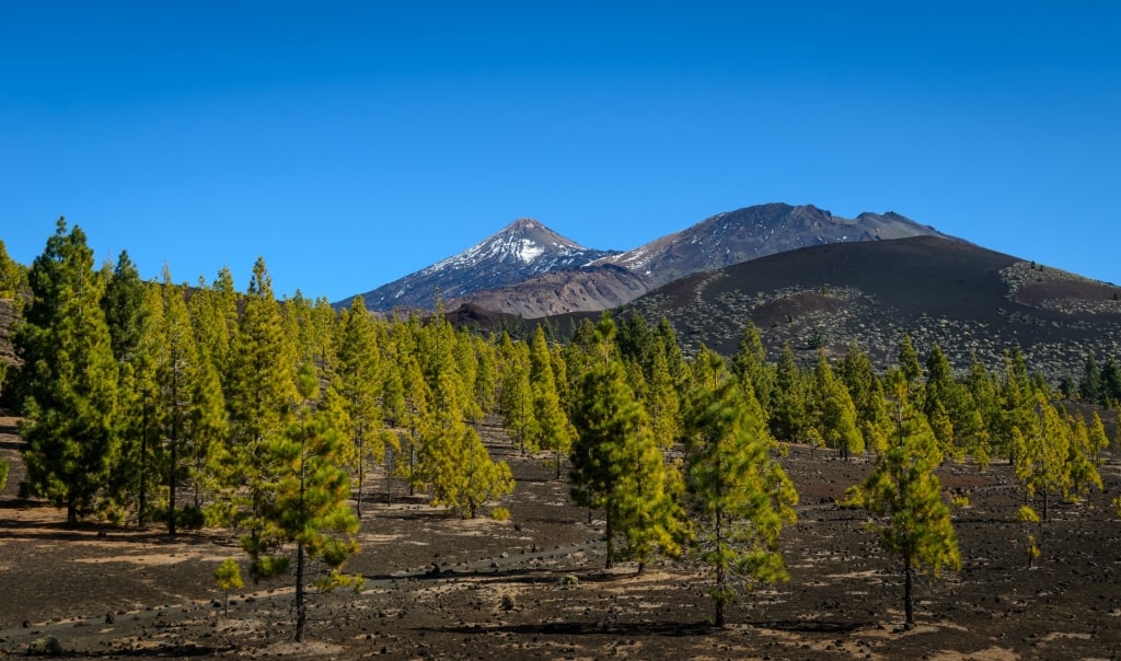
Samara in Teide National Park, Tenerife
You have a very different view on the two-and-a-half-hour Samara hike. Here, pine trees growing out of the black volcanic sand make for a surreal sight.
These Calabrian pines are a symbol of the nearby island of La Palma. Endemic only to certain islands in the Canaries, they can live up to 300 years.
The loop, like most walks in Spain, is well sign-posted and can be combined with others to make up a longer route. Climbs up to Mount Samara or other summits can be added, for example.
Teide National Park, Tenerife
Tenerife is known as the “Island of Eternal Spring” for its mild, year-round climate. Teide National Park, however, has its own microclimate and bringing layers is wise to cope with much cooler temperatures at altitude.
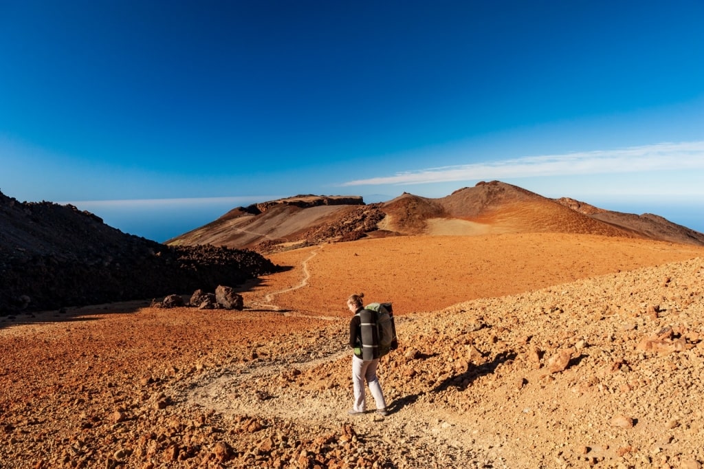
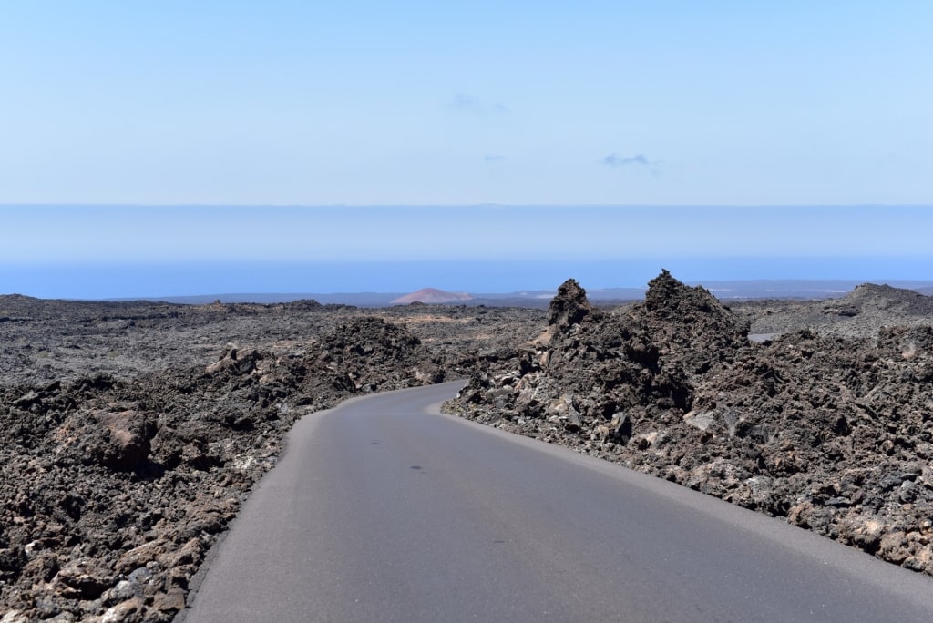
Timanfaya National Park, Lanzarote
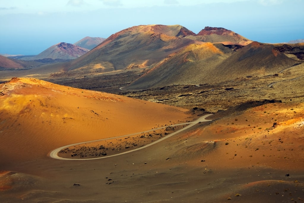
Timanfaya National Park, Lanzarote
The barren but beautiful landscape of Timanfaya on Lanzarote was created by a volcanic eruption that went on from 1730 and 1736. Timanfaya seems little changed since then, and its arid nature is reinforced by the fact you can explore it on camel rides.

El Diablo in Timanfaya National Park, Lanzarote
The volcanic heat can still be experienced if you see a guide turn water to steam by pouring it into a hole in the ground. The El Diablo restaurant even uses it to cook meals.
That lingering danger means visitors can only explore the park on guided tours. A local guide is equally essential for hikers on any unmarked routes.
The Tremesana Guided Walk is two-and-a-half miles long and takes about three hours. You need to book in advance to join it.
Timanfaya National Park, Lanzarote
The Ruta del Litoral is a five-and-a-half -mile walk along the coast, and is popular with birdwatchers. The guided route is available only one day a month but the walk can also be self-guided.
Although distances are short, the terrain is tough and, for obvious reasons, the park mandates closed footwear for walkers. Water, sun cream protection, and a head covering are also recommended.
Caminito del Rey, Málaga

Caminito del Rey, Málaga
The city of Málaga in Andalusia is near some of the best hikes in Spain. The mountains of the Alpujarra, south of the Sierra Nevada, are crisscrossed by paths based on old mule tracks, once used to carry fish from the coast up to Grenada.
Closer to Málaga itself, there is plenty of great coastal and mountain walking. The most famous walk may be the Caminito del Rey, a spectacular path that clings to a cliffside.
Built between two waterfalls for workers building a hydroelectric dam, the path is 300ft up on the walls of a sheer gorge. The dam was opened by Spain’s Alfonso XIII in 1921, leading to the walkway being called “the King’s little walk”.

Caminito del Rey, Málaga
Having fallen into a state of disrepair, it gained a reputation as one of the world’s most dangerous hikes. Major engineering works have now made it completely safe, but it’s still not for those with vertigo, thanks to the sheer drops below the cliffside path.
The Caminito del Rey starts at the town of Ardales, an hour from Málaga. It takes about three hours to walk the linear route, with a shuttle bus taking visitors back to the start.
Gorbeia Natural Park, Bilbao
Gorbeia Natural Park, Bilbao
The Basque Country has some spectacular big hikes, from the 500-mile Camino del Norte along the coast to the six-day Idiazábal Cheese Trail. The most famous is the section of the Camino del Norte from Bilbao to Santander, the start of the Camino de Santiago for many.
For a shorter hike, any part of those longer hikes will offer a good day out. There are also superb walks such as the coastal routes on Monte Buciero, near Santoña, which includes a challenging 700 steps to its lighthouse.
For a gentler day out, Gorbeia Natural Park has many options. About an hour south of Bilbao, it’s the region’s biggest natural park and a birdwatcher’s paradise.
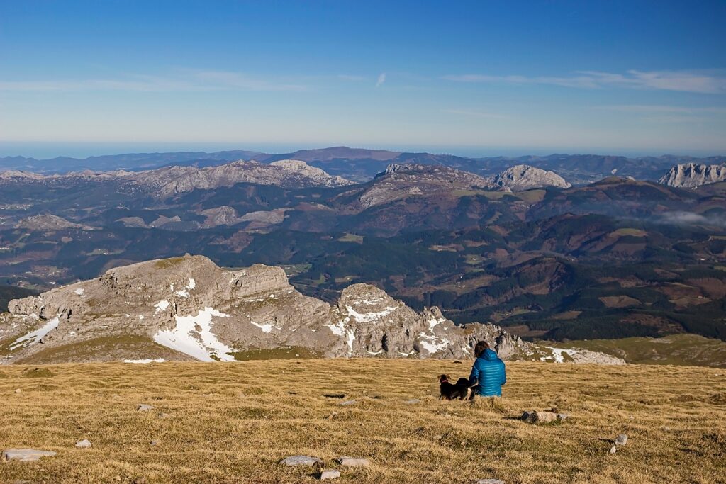
Gorbeia Natural Park, Bilbao
The scenery varies from oak forest and fertile pastures to waterfalls plunging from peaks popular with Basque mountaineers. The highest point is Mount Gorbeia at 4,862 feet.
Hiking routes vary from a few miles to the longest at ten miles. There is an equally wide choice in height gain, with the combinations making up walks from an hour to all day.
Walks are signposted and well-used. The dense woodlands are home to wild boar and deer, which have become a symbol of the park.
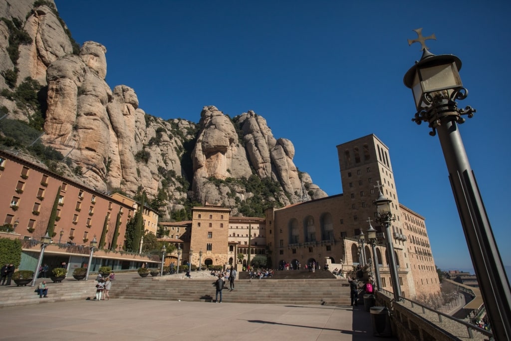
Montserrat, Barcelona
Have any of these walks inspired you to dust off your walking boots? Browse Celebrity’s cruises to Spain to find an itinerary that will help you explore the country’s magical landscapes.

