From the mountains of the mainland, to the interiors of Sicily, and Sardinia, there are plenty of walks to suit all abilities. Whether you want a short stroll in the Tuscan hills or a more strenuous hike along the wonderful Amalfi Coast, there is a route to suit.
Wherever you go, there are great views of the beautiful Italian landscape, and the seas around it. And, of course, a wonderful Italian meal to enjoy after your efforts.
Here is a list of the eight best hikes in Italy.
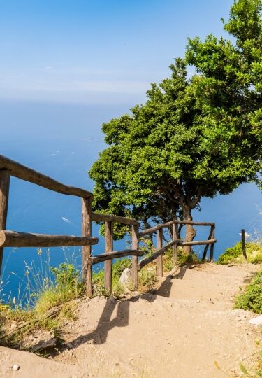
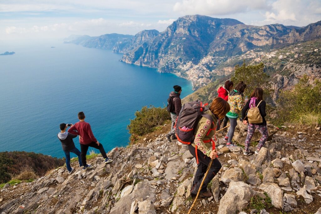
Valle Delle Ferriere, Amalfi
Valle Delle Ferriere, Amalfi
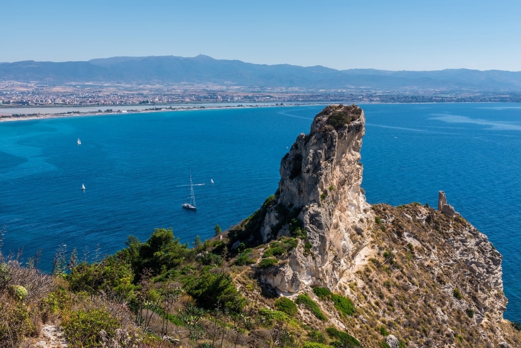
About 90 minutes from Naples, in the hills just above Amalfi, the “Valley of Ironworks” offers some spectacular views. Walk through lemon groves, past waterfalls, and among mills that produced the gorgeous Amalfi paper.
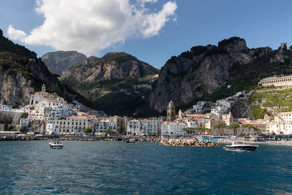
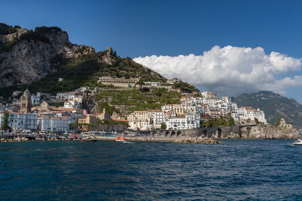
Amalfi
The valley begins in the mountains and runs down to Amalfi. You could even reach the start of the hike by walking straight up Amalfi’s main street. However, that’s a steep, 40-minute hike in itself.
Saving your energy will give you more time to enjoy the views over the Amalfi Coast’s towns. Let’s just say, your camera will be fairly busy.
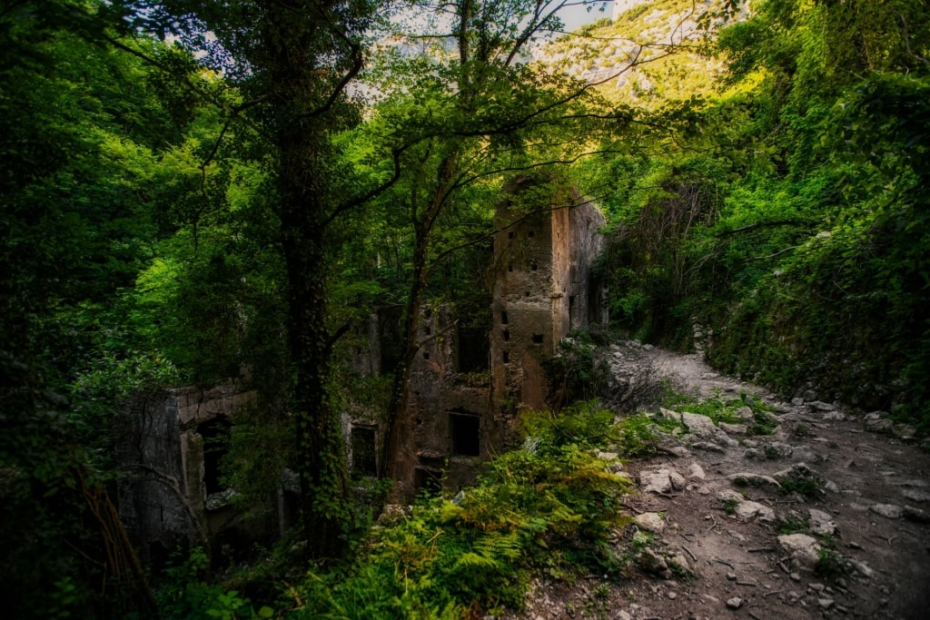
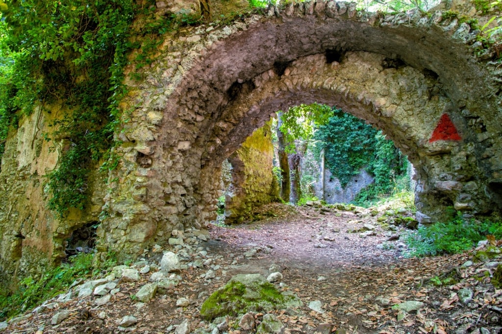
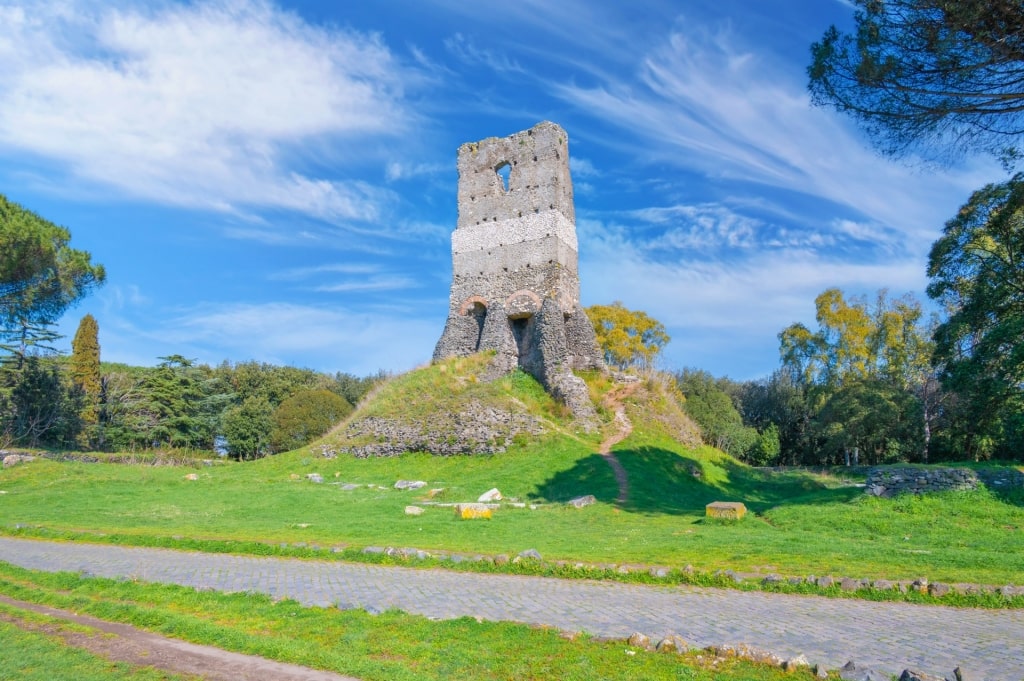
It’s hard to believe that the upper part of the valley was once a busy ironworks, powered by watermills. It fell into disuse in the 18th century, and nature has now reclaimed the landscape.
Valle Delle Ferriere, Amalfi
The valley has its own micro-climate, supporting some interesting and unusual species. These include rare ferns and even rarer frogs.
Of course, the lemon groves are more eye-catching and smell delightful. First planted to sell to ships, for the prevention of scurvy onboard, the lemons are now more used in scents and limoncello.
Valle Delle Ferriere, Amalfi
You can find out more about the paper mills in the Amalfi Paper Museum, Museo della Carta. In 1700, there were 11 paper mills here, but industrialization saw the last close in 1954.
Mount Arcosu, Sardinia
Mount Arcosu, Sardinia
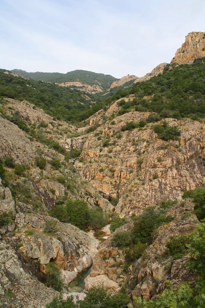
Monte Arcosu takes its name from the arched shape of its isolated peak. Standing just over 3,000 feet in height, it’s visible from afar and is an easy drive from Cagliari.
The mountain also gives its name to a surrounding nature reserve that is much less challenging to the casual hiker. With almost 15 square miles of forest, Oasi di Monte Arcosu is part of a much larger forested area roamed by deer, boars, and foxes.
Mount Arcosu, Sardinia
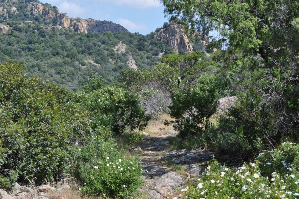
With a total of 50 miles of well-marked hiking trails, there is much to see, smell, and hear in the forest. The protected area also includes two different river valleys that bring a rich variety of terrains and flora.
Among the most common trees are holm, and cork oaks. “Holm” is an old word for holly; the holly-like leaves of the young trees are an adaptation to heat, and grazing wildlife.
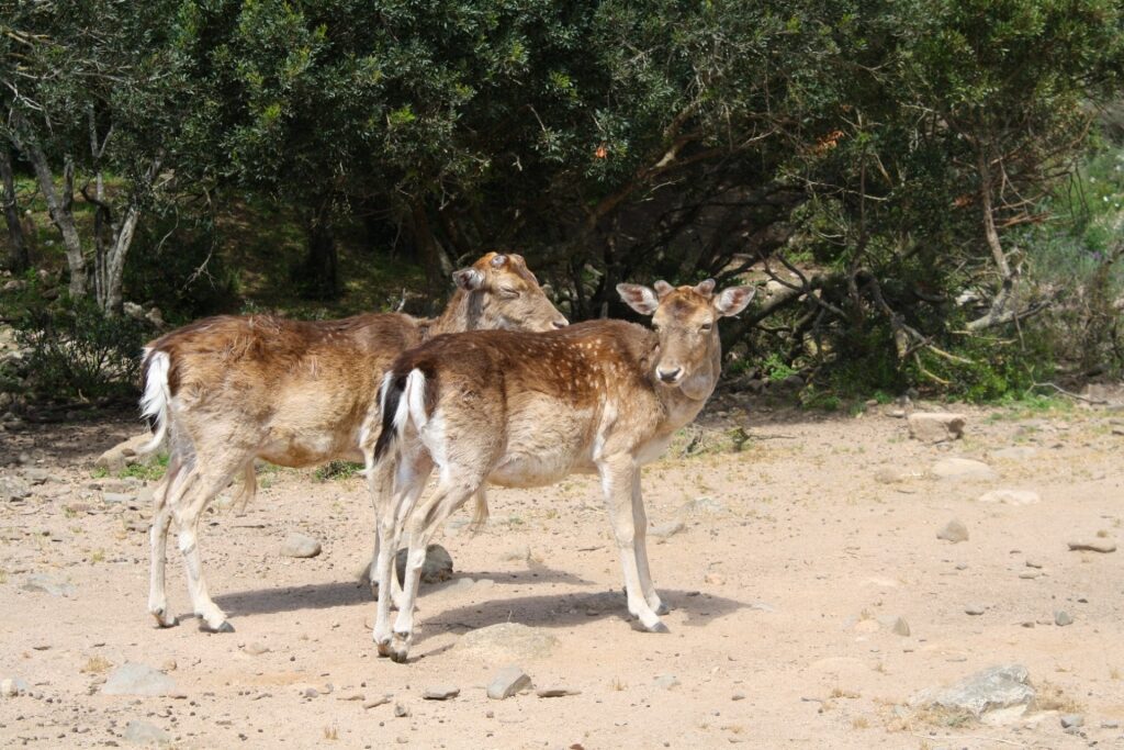
Sardinian deer
The endangered Sardinian deer is another species to look out for. Reduced to a population of maybe 80 animals in the 1980s, there are now over 2,500 locally.
Fallow deer have also been introduced, and are a lot less shy. Birdwatchers will also enjoy looking for rare species such as the Sardinian goshawk, and even rarer golden eagle.
Read: Why Visit Sardinia
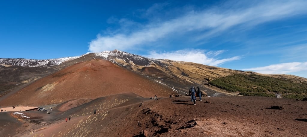
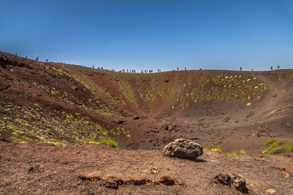
Silvestri Craters, Mt. Etna, Sicily
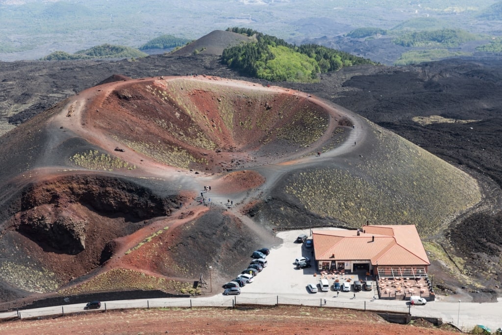
Silvestri Craters in Mt. Etna, Sicily
Mount Etna is almost 11,000 feet in height, although, as the most active volcano in Europe, that’s somewhat subject to change. One of the greatest natural wonders in Italy, the day-long hike to the top is a popular thrill, although perhaps only for the brave, and certainly the fit.
However, there is a less daunting, much shorter hike on Etna near Rifugio Sapienza. Within sight of the cable car base station are two craters, one large, one small, and both with great coastal views.
Silvestri Craters in Mt. Etna, Sicily
These Silvestri Craters are both inactive, having been formed as the result of an eruption in 1892. A circuit of both involves very little climbing, although you do have to be careful of stumbling in the soft soil.
The lower crater is the easiest, as the walk is relatively flat. The upper one involves a steeper ascent but is still very manageable.
Silvestri Craters in Mt. Etna, Sicily
You can climb down into either crater, with the lower crater again an easier option. The barren landscape of both will make you feel as if you are on Mars.
Recover from this alien experience at the refuge, where you’ll find souvenirs to mark your European adventure. Another great reminder of your trip is a jar of fragrant local honey.
Do remember that the altitude here makes temperatures much colder than at the coast. Bring layers, good hiking boots, suntan lotion, and plenty of water.
Read: Magical Towns in Sicily
Appian Way, Rome
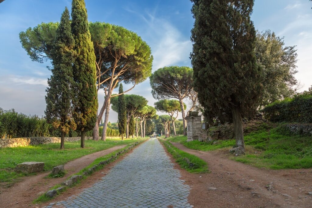
Appian Way, Rome
The Appian Way was built to link Ancient Rome to Capua, near Naples, and then on to the major port of Brindisi. Named for the bureaucrat behind it, Claudius Appius Caecus, part survives today as the Via Appia Antica.
Walking on the road outside Rome is to follow the footsteps of travelers, soldiers, and pilgrims. The church of “Domine Quo Vadis?” fame is here, where Jesus is believed to have met Saint Peter, although the road’s history dates back three centuries earlier.
Ancient Rome forbade burials within the city walls, so you will find many memorials. You’ll also see early Christian burial sites such as the Catacombs of San Callisto and Sebastian.
Appian Way, Rome
Now protected inside an archaeological park, the first few miles of the road have no houses except opulent villas and family farms. And, of course, they are lined with the cypress trees that once shaded those Roman armies on the march.
The rural feel is a strong contrast to the traffic anarchy of Rome itself. Although parts are still open to local traffic (except on Sundays), you can safely walk on the cobbled paving.
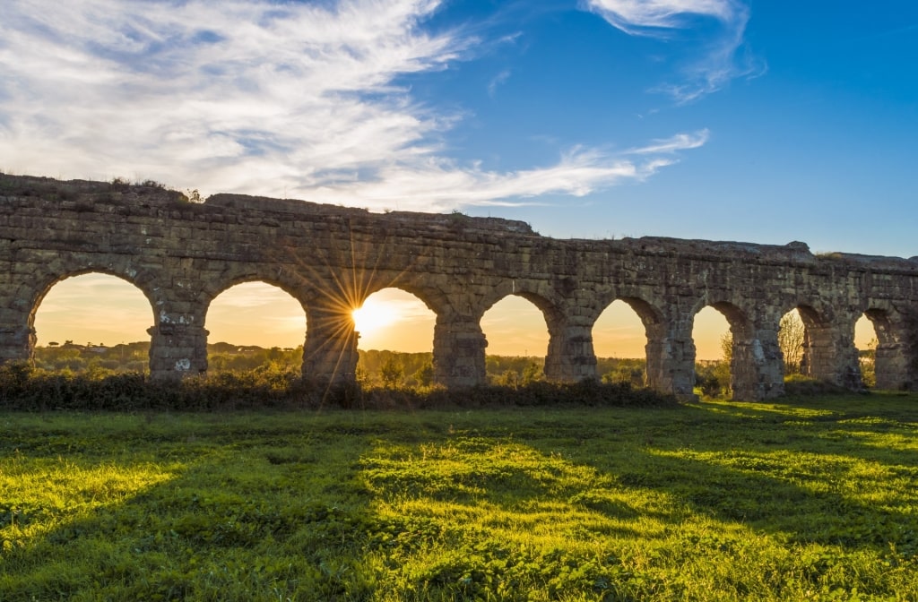
Parco degli Acquedotti, Rome
While you are here, don’t miss Parco degli Acquedotti, one of Rome’s most famous landmarks. This park protects the remains of two major aqueducts: Aqua Felix, and Aqua Claudia.
Read: Best Day Trips From Rome
Path of the Gods, Naples
Path of the Gods, Naples
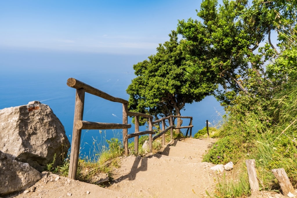
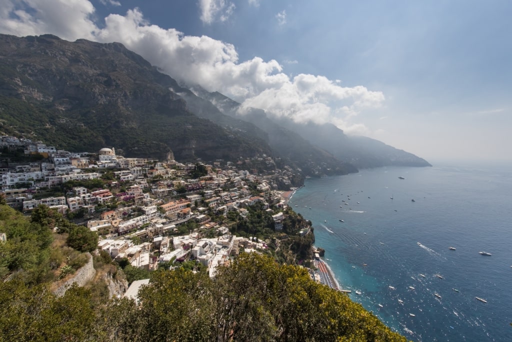
The Sentiero degli Dei is a walking trail between Bomerano, near Agerola, and Nocelle, near Positano. Running for five miles, it follows old mule trails and delivers spectacular views of the Amalfi Coast. For sheer beauty of scenery, this is some of the best hiking in Italy.
Bomerano is about an hour from Naples, and the walk is best done in the early morning. That’s partly to escape the summer heat, but also because the afternoon light will be in your eyes.
Positano
From Nocelle, you can walk on to Positano but it’s a steep climb down almost 2,000 steps. If you don’t want that extra exertion, a good option is to just return to Bomerano for a second bite of the views.
And what views they are. Home to some of the most beautiful coastal towns in Italy, the Amalfi Coast is famous for a reason, and here you enjoy its splendors far above the road traffic, and the crowds.
You’ll walk through ancient terraces of vines or olives, and past old farmhouses. You’ll smell the fragrance of Mediterranean herbs, and maybe meet some local shepherds.
Path of the Gods, Naples
In the distance is the island of Capri, and Li Galli Archipelago. With the sparkling sea below, and bright blue sky above, it’s easy to imagine how the path was named.
In places, the cliffside path is not for those with vertigo (the most potentially alarming part has a diversion through woodland). Apart from that, it’s easy walking and well-marked with red-and-white signs from the Club Alpino Italiano (CAI).
Read: Best Things to Do on the Amalfi Coast
Monte di Portofino, Portofino
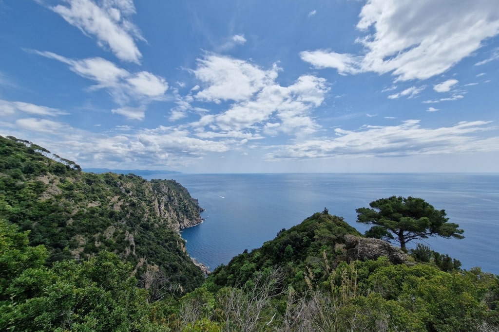
Monte di Portofino, Portofino
If you can tear yourself away from the almost impossibly picturesque town of Portofino, there are many great hiking trails in Portofino Natural Park. The most popular is the easy five-mile walk to Santa Margherita Ligure.
San Fruttuoso, Portofino
However, the walk to San Fruttuoso is a quieter, if more challenging route. Even so, it’s only two hours or two-and-a-half miles one-way, and relatively flat after the steep climb to start.
You’ll need to be reasonably fit, both for the climb up from Portofino, and the corresponding one down into San Fruttuoso. A lovely, easy option for the return is to just take one of the regular ferry boats.
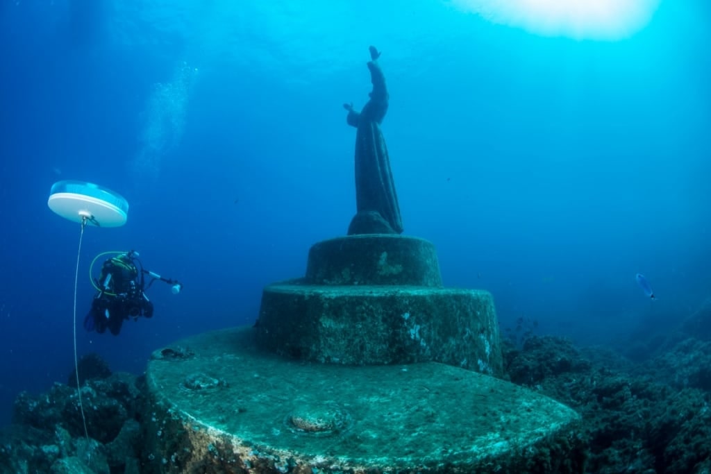
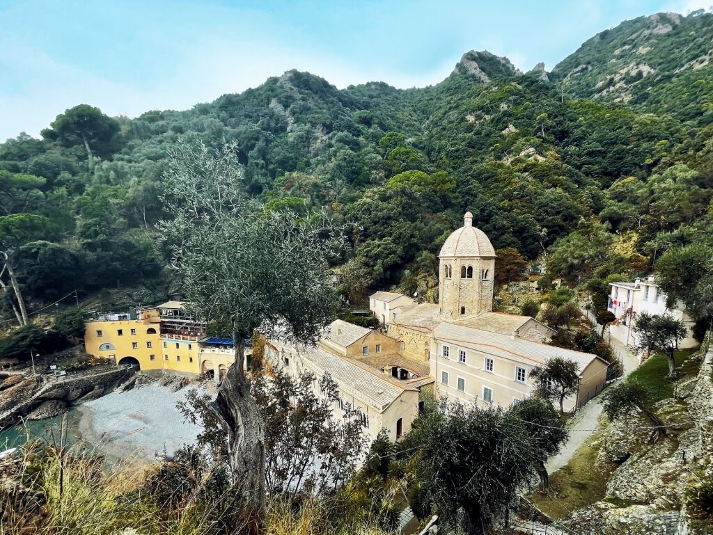
Christ of the Abyss
These take visitors to see San Fruttuoso’s 14th-century abbey, and one of the world’s most beautiful underwater statues in its bay. The Christ of the Abyss can be seen from glass-bottomed boats, or by snorkelers and divers.
The views from the trail may not be so unusual, but they are still wonderful. One advantage of that is it gives you plenty of excuses to stop and take photos.
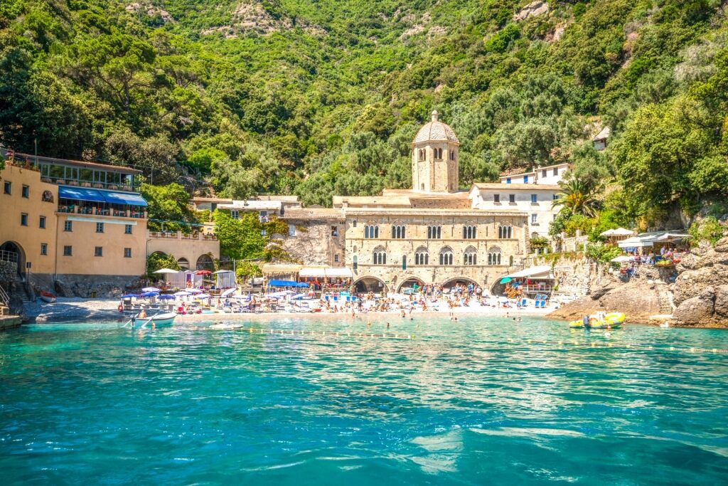
San Fruttuoso Bay
Even if you are not diving to the statue at the end, you’ll want to bring a swimsuit to cool off with a swim from the tiny pebbled beach. It’s a great reward for the walk, which is best done early in the day.
Sella del Diavolo, near Cagliari
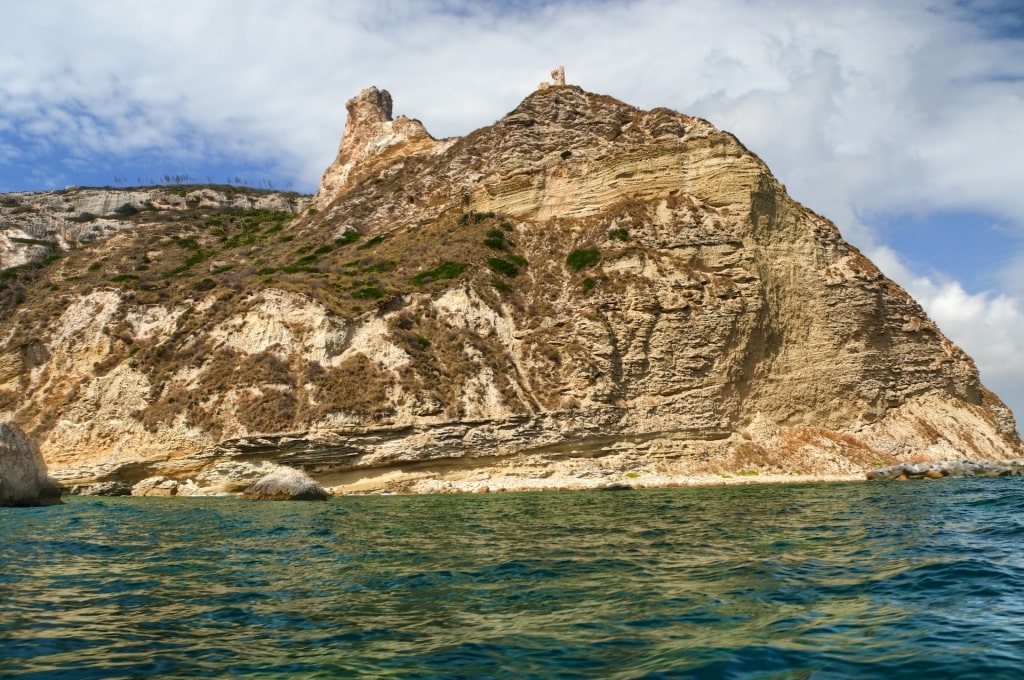
Sella del Diavolo, near Cagliari, Sardinia
The Sella del Diavolo is a prominent central landmark separating Cagliari’s Poetto and Calamosca Beaches. Its height and location promise great views, and the reality will not disappoint.
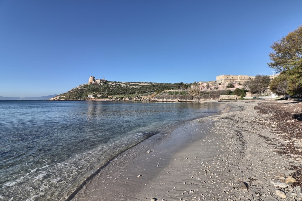
Calamosca Beach, near Cagliari, Sardinia
The hike up starts behind Calamosca Beach, and takes about 45 minutes at most. The ground can be slippery, however, so don’t underestimate it; good hiking shoes are essential, as is lots of water.
The trail, marked by green dots on the rocks, is easy to follow among the low vegetation. You’ll pass through junipers, and old olive trees, and maybe see falcons, or kestrels hunting for a rabbit.
Sella del Diavolo, near Cagliari, Sardinia
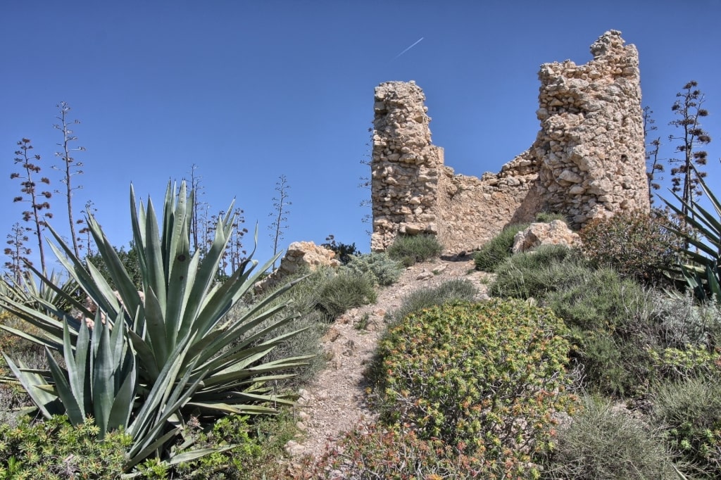
From the top, the bird’s-eye views will give you an appreciation of the peak’s strategic importance. That explains the blockhouse, towers, and other lookouts dotting the saddle of the hill.
The caves on its slopes were once lived in, and there are ruins of an ancient temple, as well as an 11th-century monastery. Water tanks dating to both Punic and Roman times can also be seen.
Sella del Diavolo, near Cagliari, Sardinia
The area’s name is said to be from a fight over its beauty. Lucifer wanted to own it, but the angels fought him off.
During this titanic struggle, the devil’s saddle fell to the ground, creating Sella del Diavolo. The victorious angels gave their name to the Golfo degli Angeli below.
Poetto Beach in Cagliari, Sardinia
To cool off afterwards, visit Poetto or Calamosca, both lovely Italian beaches. You won’t have to look too far to find a refreshing ice cream, either.
Renaissance Ring, Florence
The Anello del Rinascimento is a 100-mile walking route around Florence (various side trips add another 50 miles). While few have time to tackle the whole, there are several interesting stages within easy reach of the Tuscan capital.
Piazzale Michelangelo, Florence
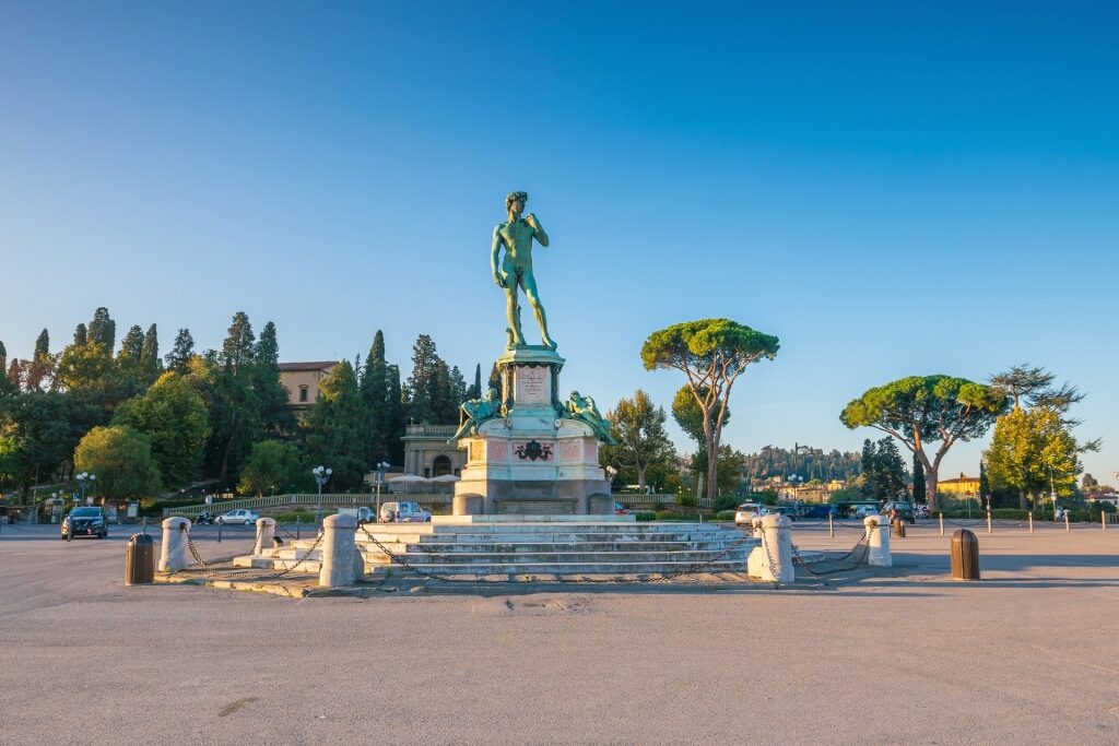
The easiest of these is the short leg from Impruneta to La Certosa, which delivers unusual views of Florence. Add on the five-walk to or from Piazzale Michelangelo, with its spectacular views of the city, for an even better experience.
The Impruneta-La Certosa section is about four and a half miles, and involves 300 feet of altitude, all downhill if you start in Impruneta. Either end is easy to reach by car, taxi or bus, and maps are freely available at tourist offices or online.
Florence
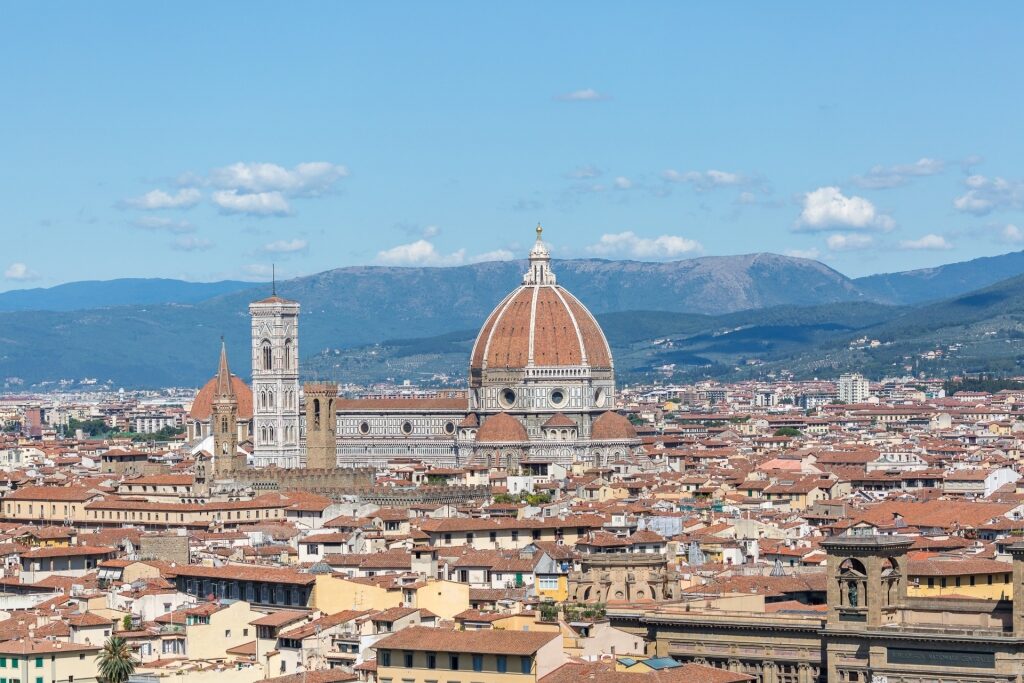
The walk is on a mix of quiet roads and dirt tracks, passing through olive groves and small settlements. Views, apart from the beauty of Florence itself, and its pretty countryside, take in the Apennines, and the Pratomagno mountain range.
Highlights include the atmospheric church of San Miniato a Quintole, with its cemetery, fountain, and fragments of a 14th-century fresco. Look out also for the beautiful Villa Antinori, and Villa Brancolano, with its 300-year-old Lebanon Cedar, both houses dating to the 15th century.
Amalfi
Has this list of the best hiking in Italy given you the urge to get off the beaten path? Then browse our Italy cruises to find the perfect vacation to explore the land of La Dolce Vita.

