If alpine and foothill treks entice, the Japanese Alps, divided into the Kita range in the north, the central Chuo range, and the southern Minami range, will serve up more hiking opportunities than you could hope to complete in a single lifetime.
On the northern island of Hokkaido, you can explore the Ishikari and Hidaka mountains, and different volcanic peaks. Abundant rainfall across the entire archipelago leads to lush forests, pretty ponds, lakes, and cascading waterfalls dotted along many of the trails you’ll visit—along with the occasional steaming thermal volcanic vent.
So strap on your hiking boots and set off on some of the best hikes in Japan.
Owakudani Hiking Trails, Shimizu
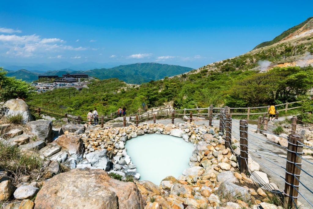
Owakudani Hiking Trail, Shimizu
The Owakudani hiking trails are near the Port of Shimizu and Mt. Fuji. You’ll likely note wafting sulfurous vapor emanating from the volcanic crater during your rambles here.
Ropeway in Owakudani, Shimizu
After zipping up the ropeway to Owakudani Station, you can walk along a well-maintained trail to a zone full of steaming thermal vents and pools. When the clouds lift, you’ll be treated to spectacular views of Mt. Fuji.
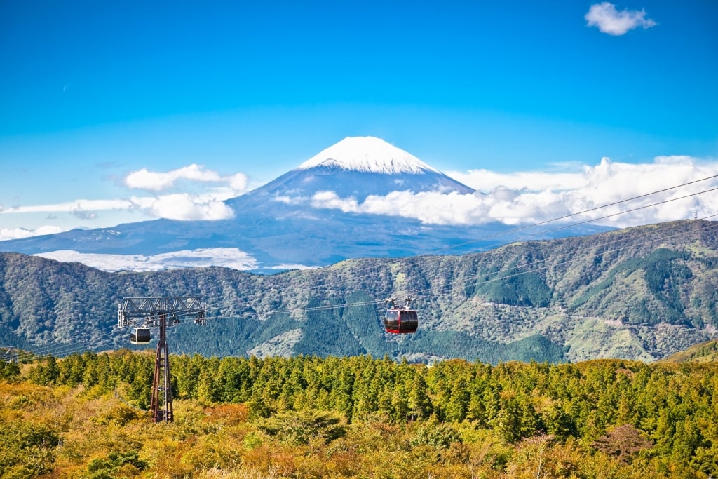
If you’re the hearty type looking for a more strenuous hike, and you have a few hours to spare, you can slog up to Mt. Kamiyama from Owakudani Station, Fuji-Hakone-Izu National Park’s tallest mountain.
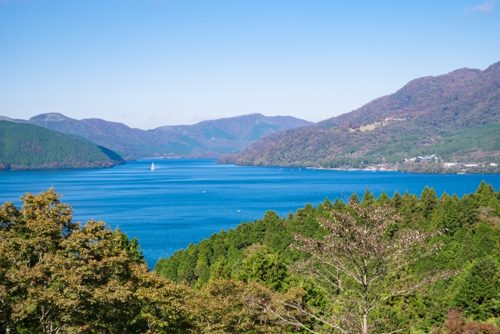
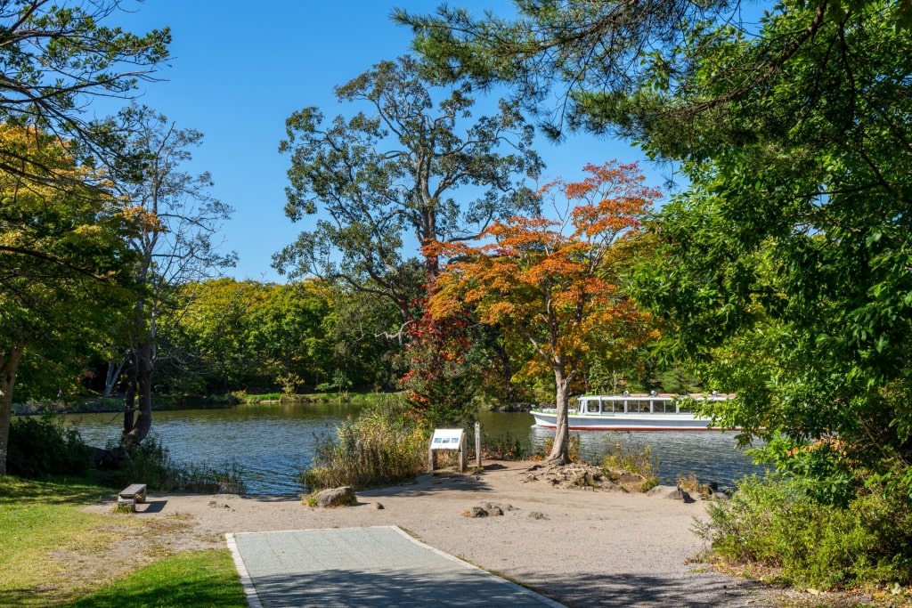
Lake Ashinoko, Shimizu
From Mt. Kamiyama, you can head back to Owakudani Station, scramble over Mt. Komagatake, or hike down to Lake Ashinoko—one of the most beautiful places in Japan—with different ropeways along the way to help return you to your starting point.
Shirakami-Sanchi Forest, Aomori
Shirakami-Sanchi Forest, Aomori
The Shirakami-Sanchi Forest’s diversity of flora, and captivating topography, make this rugged UNESCO World Heritage Site one of the best hiking regions in Japan.
Located on Honshu Island’s northwest coast, Shirakami-Sanchi boasts a thick, virgin Siebold’s beech virgin forest through which you can amble.
Shirakami-Sanchi Forest, Aomori
The region is also laden with ponds, lakes, waterfalls, and mountains (like Shirakami-dake), with temperate greenery surrounding you at every turn.
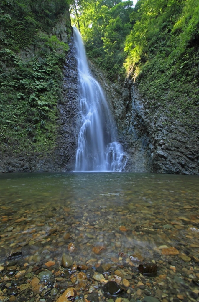
Anmon Falls, Aomori
The tumbling, three-tiered Anmon Falls is a big draw here, as is the forested Juniko Twelve Lakes district’s dozens of ponds and smallish lakes—definitely numbering more than 12.
Nihon Canyon, close to Juniko, cuts through the fertile woodlands like a gray scar, adding another striking geological element to your walks through the Shirakami-Sanchi region.
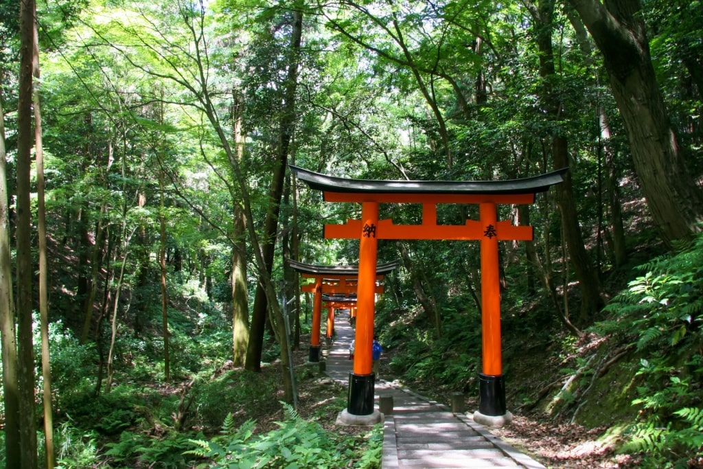
Fushimi-Inari Hike, Kyoto
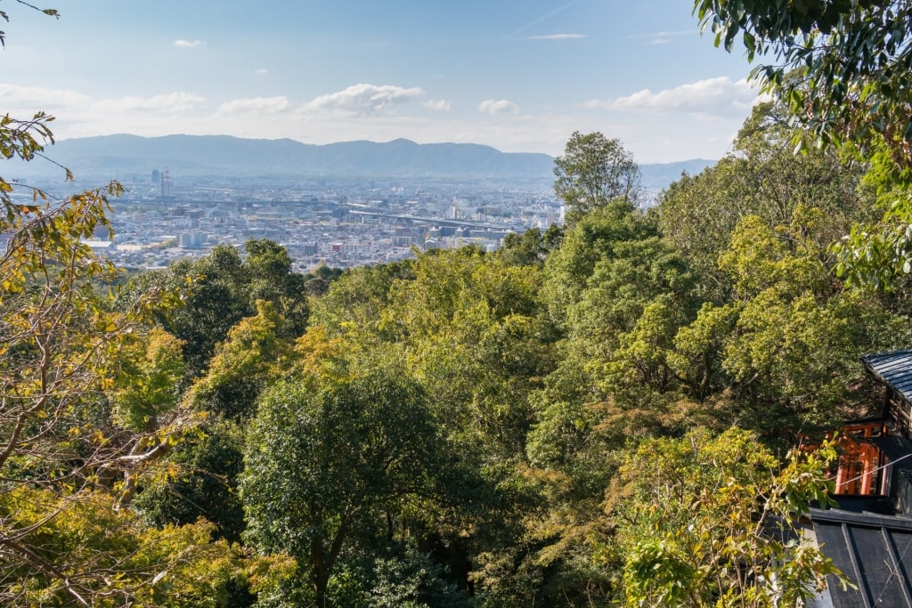
View from Fushimi-Inari, Kyoto
A trek around Mt. Inari, along the eastern flanks of Kyoto, combines the best of Japan’s traditional Shinto culture, including a visit to the bustling Fushimi Inari Shrine, with a heritage-rich hike through lovely woodland trails and a bamboo forest.
The Fushimi Inari Shrine, devoted to the fox deity Inari, is famed for its long vermilion tunnel of sacred torii gates. The often-crowed Senbon-no-torii gate tunnel leads the way to the hiking paths, which in turn lead toward the summit of Mt. Inari.
Fushimi-Inari, Kyoto
While climbing, you’ll spot tea houses, fox sculptures, small Shinto shrines, and engraved worshiping stones. You can stop mid-journey at the Yotsu-suji lookout and admire the views of the trees below you, and parts of Kyoto beyond.
You can then continue your ascent toward the Kami-no-Yashiro shrine, located atop Mt. Inari. A roundtrip journey should take you around two to three hours, depending on your fitness level, with waterfalls and sheltered shrines to visit during your descent down.
Read: Two Days in Kyoto
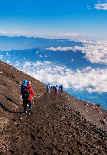
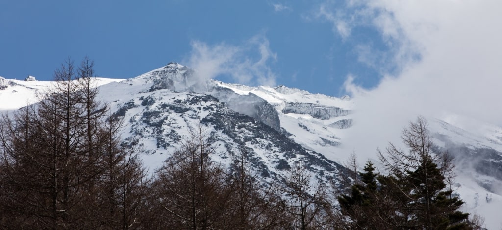
Mt. Fuji, Shimizu
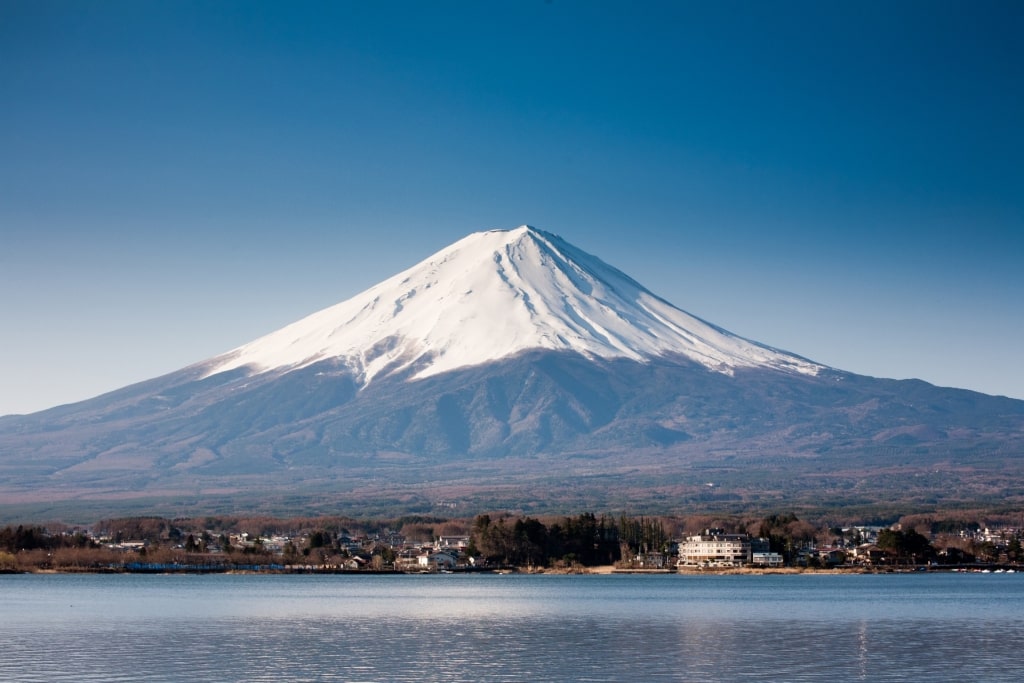
Mt. Fuji, Shimizu
Mt. Fuji is one of the best hikes and an iconic destination for first-time visitors to Japan. And despite this basaltic stratovolcano’s impressive 12,388-foot height, reaching the top isn’t as arduous an undertaking as you might expect.
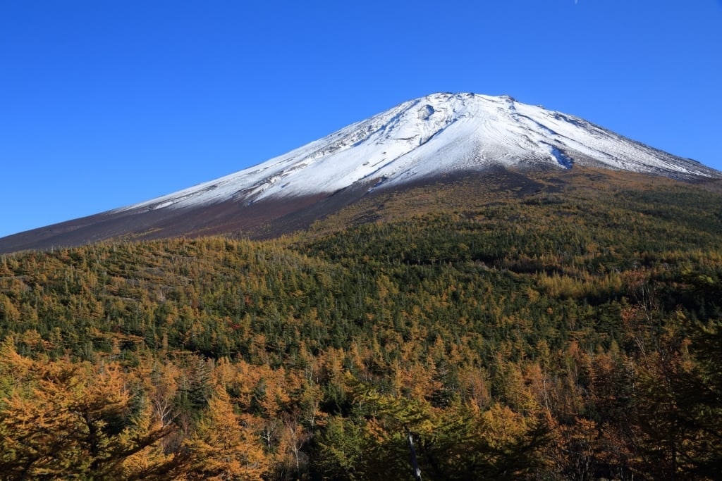
5th Station, Shimizu
Assuming you’re in shape for a somewhat strenuous hike, although nothing extreme, you can hop on a bus heading up to the dome-shaped mountain’s Fuji Subaru Line 5th Station, placing you at around 8,000 feet above sea level.
As soon as you disembark, you’ll be rewarded, on clear days, with far-reaching views of Fuji Five Lakes in the striking valley below the volcano, and the snowy summit looming above your head.
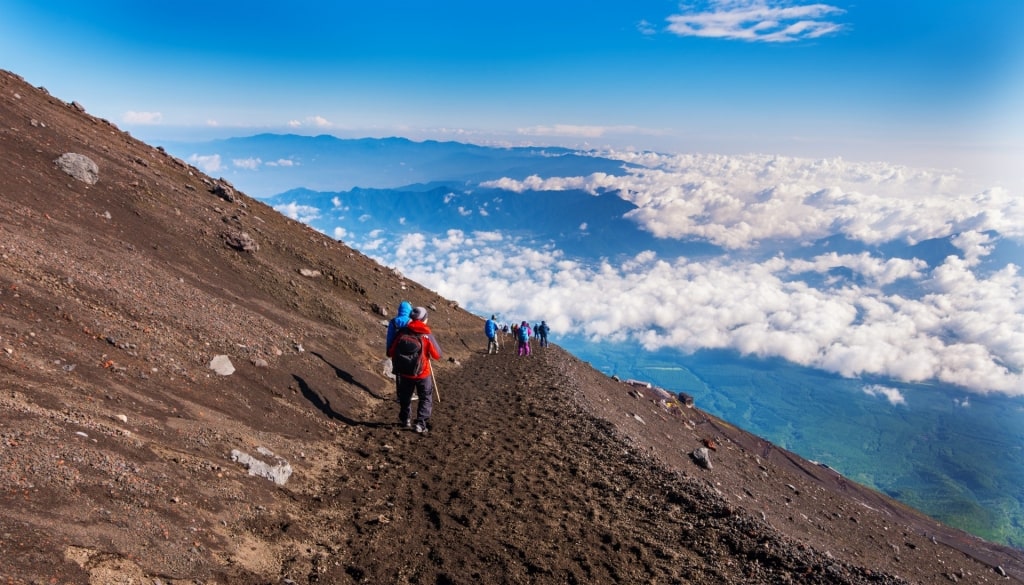
Yoshida Trail in Mt. Fuji, Shimizu
From the 5th Station, assuming you’ve arrived during hiking season, which usually runs from early July through early September, you can pick one of several routes, like the popular Yoshida Trail, to ascend the summit of this famous Japanese mountain.
Most of the paths to the top tend to snake back and forth, giving the trails fairly gentle gradients, even with the elevation gain.
You’ll notice plenty of facilities and mountain huts along the tracks, where you can rest your tired body (remember, there’s less oxygen at these altitudes), stop for a snack, and take in the soaring vistas before resuming your climb toward the summit.
Arimura Lava Observatory, Kagoshima
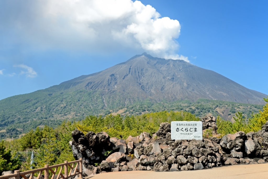
Arimura Lava Observatory, Kagoshima
In Kagoshima Bay, at the southern end of Kyushu Island, a short walk runs along a paved trail toward the Arimura Lava Observatory. The path, and the observatory, will let you get up close to the Sakurajima stratovolcano’s still-active, often rumbling crater.
The cone-shaped Sakurajima dominates the skyline in and around Kagoshima Bay. The volcano used to be an island unto itself, until oozing lava from the 1914 Taisho eruption linked it to the main island in the east, turning the island into a circular peninsula.
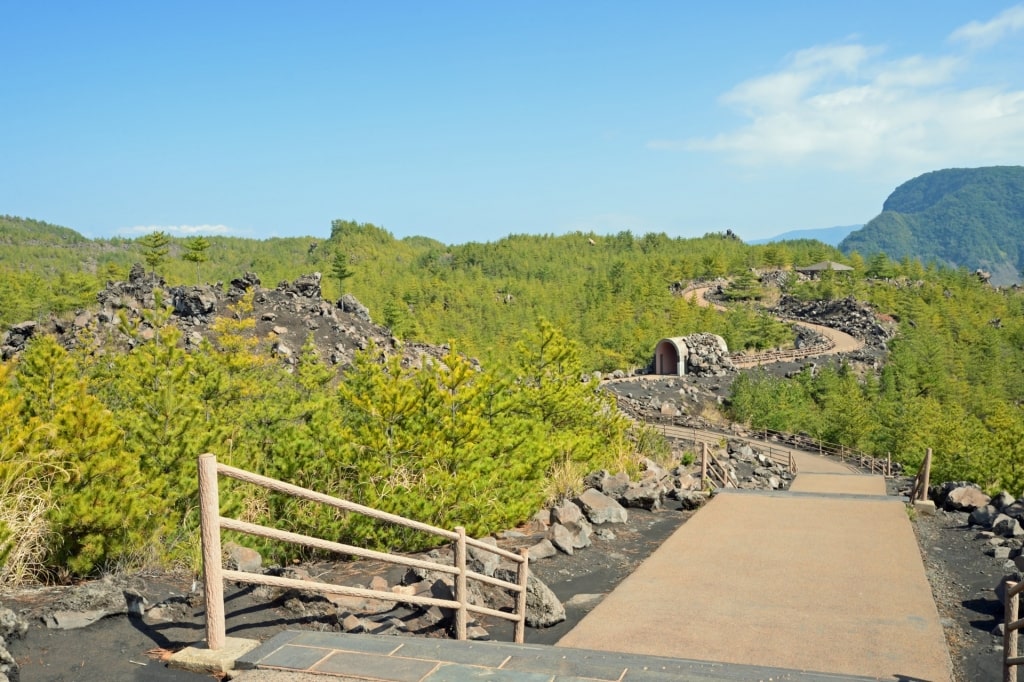
Arimura Lava Observatory, Kagoshima
The stroll out to the observatory, located on the southern flanks of the mountain, passes by a 1946 lava field. You’ll be treated to spectacular views of the steaming volcano’s southernmost peak, one of three.
If you’d like to explore further, you can hop onto the Nagisa Lava Trail, just under two miles in length, beneath the smoldering volcano. The Nagisa trailhead is close to the Sakurajima Ferry Terminal, on the small peninsula’s western shore, slicing through the lava zone formed by the 1914 eruption.
Mt. Hakodate, Hakodate
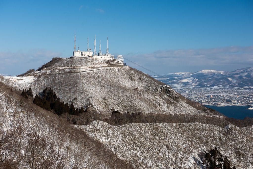
Mt. Hakodate, Hakodate
Mt. Hakodate, jutting out on a peninsula pushing up against the southern edges of the port city of Hakodate, is considered one of the best hikes in northern Japan.
If pressed for time, you can opt for a quick aerial ride on the Mt. Hakodate Ropeway up to the Mt. Hakodate Observatory. From the towering observatory platform, you’ll have commanding views across Hakodate, the Tsugaru Strait, and Hakodate Bay.
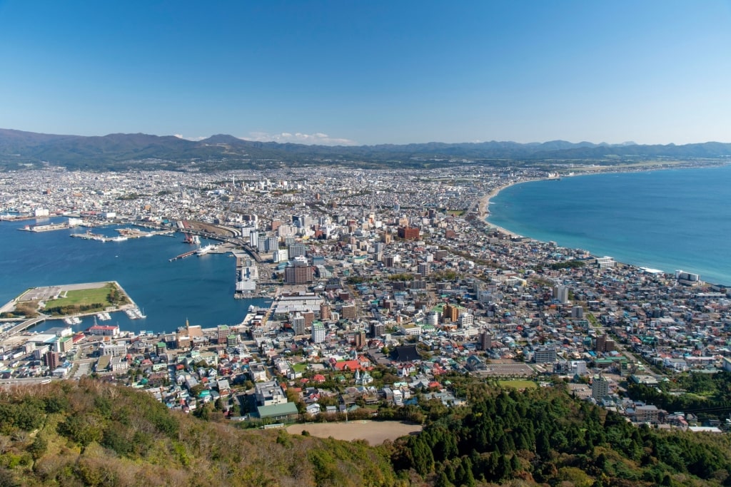
View from Mt. Hakodate, Hakodate
But if you’re itching for a steep hike, give the cable car a miss and opt for the woodland trek to the summit instead; the summit comes in at just over 1,000 feet above sea level. You’ll pass by old military battlements and masses of greenery during your ascent, which should take an hour or so to complete.
Cape Tachimachi, Hakodate
You can also head over to Cape Tachimachi, southeast of Mt. Hakodate for a short, but strenuous 15 to 20-minute hike. The trail leading to the craggy cliff top lookout is accessible from the Yachigashira Tram Stop.
As you walk toward Cape Tachimachi’s grassy, scenic bluff, hovering 100 feet or so above the crashing ocean waves, you’ll pass by Hakodate Shiei Sumiyoshimachi Kyodo Cemetery’s many tombstones.
You also find the gravesite of renowned Japanese poet Ishikawa Takuboku here, worth noting, especially if you’re interested in Japanese literature.
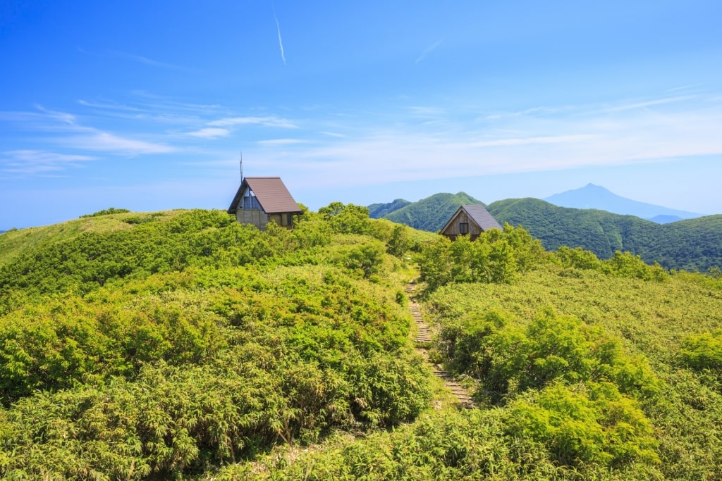
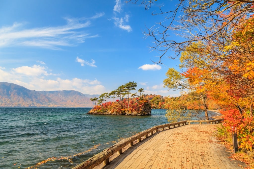
Towada-Hachimantai National Park, Aomori
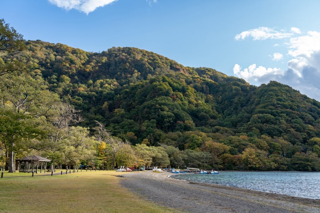
Towada-Hachimantai National Park, Aomori
Mt. Hakkoda, which shouldn’t be confused with Hokkaido’s Mt. Hakodate, as the English spellings are somewhat similar at first glance, is south of Aomori, on Honshu’s northern coast.
The volcanic peaks here, and adjacent hiking trails, lie inside Towada-Hachimantai National Park.
One of the best places to visit in Japan, this mountainous region is packed with leafy walking trails and thermal vents. The Hachimantai area, in the southern reaches of the park, is home to acidic hot springs, which you can soak in if you don’t have overly sensitive skin.
You can also trek around the green slopes near Mt. Akita-Komagatake, an active volcano.
Towada-Hachimantai National Park, Aomori
Thermal activity abounds across the grassy valleys, highland marshes, and peaks of Towada-Hachimantai National Park. The dense forests around Mt. Hakkoda turn color during the fall in Japan; the red and orange hues are something to behold, should you arrive during this time of year.
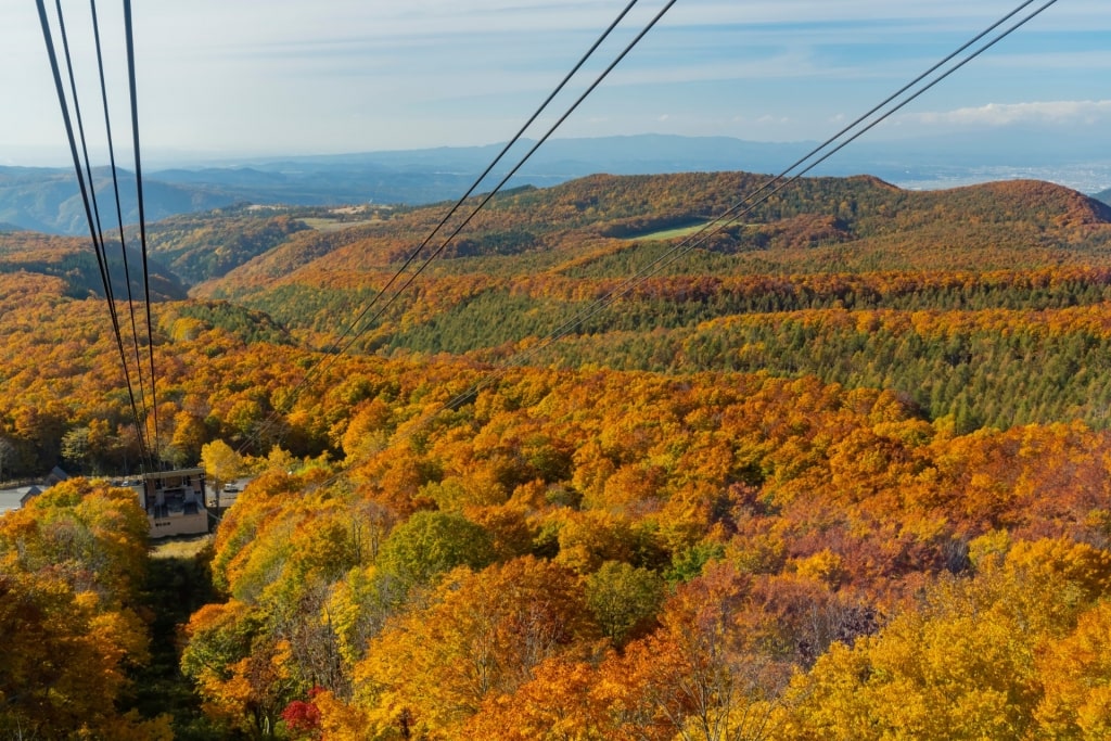
Hakkoda Ropeway, Aomori
You can reach Mt. Hakkoda’s summit via the Tamoyachidake Nature Trail to access the amazing wilderness views, or else hitch a ride on the Hakkoda Ropeway.
No matter how you arrive, try to visit the park’s 300-year-old Sukayu Onsen. This elegant, wood-decorated spa is perfect for a steamy bath, at more than 3,000 feet of elevation.
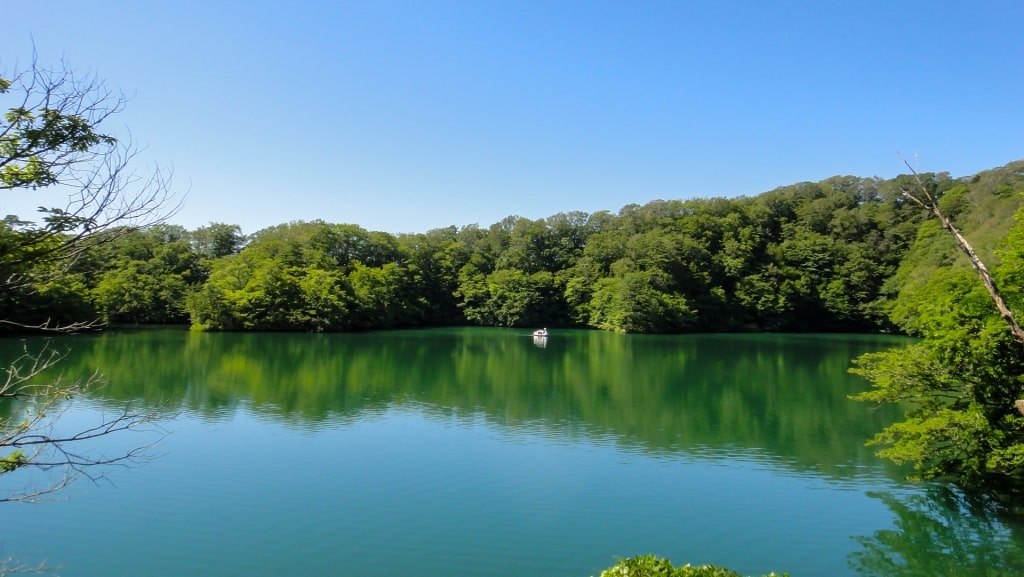
Onuma Quasi-National Park, Hokkaido
Onuma Quasi-National Park, Hokkaido
For a stylish, easy-to-navigate curated nature, you’d be remiss if you didn’t devote a leisurely morning or afternoon to a stroll around Onuma Quasi-National Park, on Hokkaido Island, north of Hakodate.
Onuma Park comprises Lake Onuma, home to a little more than 120 islets, along with the smaller Junsainuma and Konuma lakes. Mt. Komagatake serves as an arresting volcanic backdrop to the park.
Onuma Quasi-National Park, Hokkaido
One of the highlights here is the walking course, spanning 18 bridges, connecting many of the timbered islands to one another across Lake Onuma.
The walk should take you around two hours or so to complete. Onuma Park is ideal for gentle hikes surrounded by calm water and bucolic scenery.
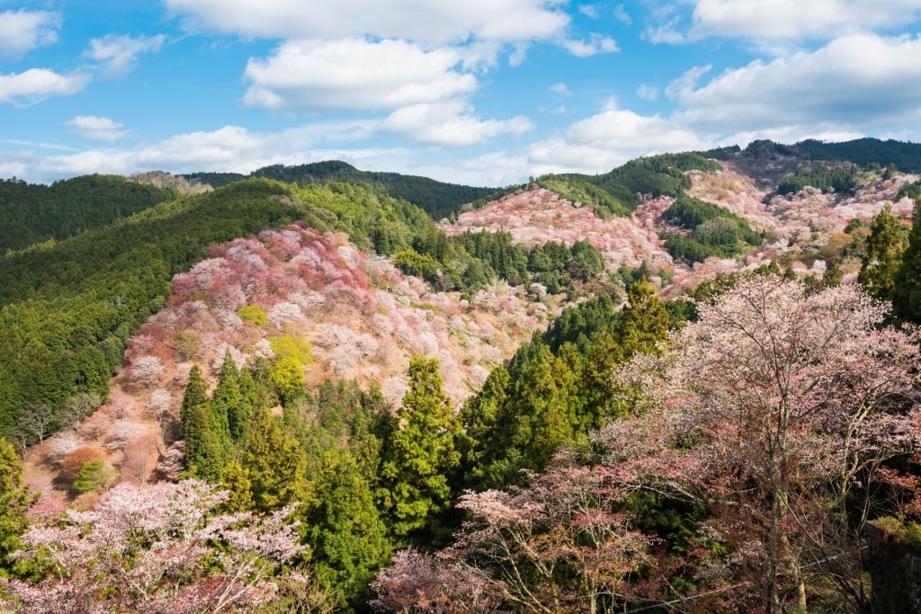
Yoshino-Kumano National Park, Osaka
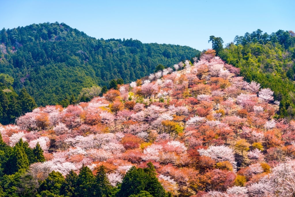
Yoshino-Kumano National Park, Osaka
If you want to gaze at the legendary cherry trees that Japan is known for, add Yoshino-Kumano National Park to your Japanese hiking circuit. This park is a utopia of diverse flora and wide-ranging topography.
The biggest attraction here is Mt. Yoshino, celebrated for its broad footpaths winding through a sea of cherry trees. Springtime is cherry blossom season, but summer hikes are lovely here too, as are autumn treks when the foliage turns colors.
As you gain elevation on Mt. Yoshino, you’ll pass by the Hanayagura Observatory on your way to the Takagiyama Observation Deck, both with splendid views of the forested hills and landscape below. You’ll wander past several different Japanese temples and Shinto shrines as well.
Omine Mountain Range in Yoshino-Kumano National Park, Osaka
Yoshino-Kumano National Park is also home to the Omine Mountain Range, jam-packed with rugged hiking trails, which lead to various summits, including Mt. Hakkyogatake, the range’s highest peak.
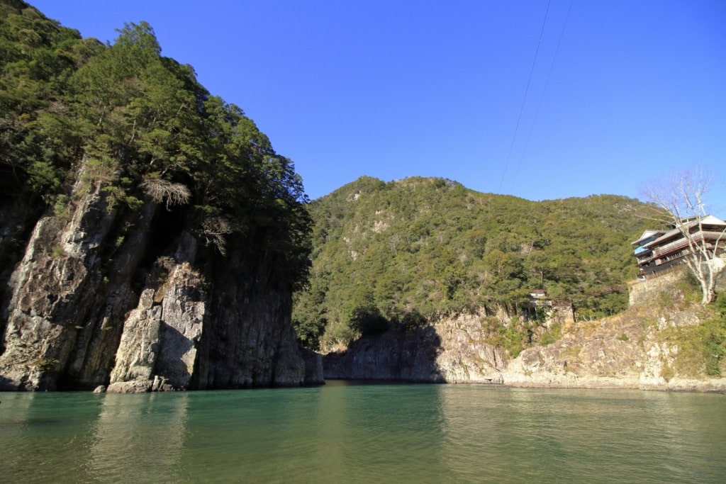
Dorokyo Gorge in Yoshino-Kumano National Park, Osaka
Another incredible geological feature in the park is Dorokyo Gorge, with steep cliffs abruptly emerging from tree-lined slopes, dropping down into the Kitayama River below.
You’ll find scenic walks near the river and along the cliff ledges. If you want to experience the ravine’s lush scenery from the water, arrange a jet boat ride, then gaze up at the rocky cliffs pinching you in from both sides of the Kitayama.
Mt. Fuji, Shimizu
Discover the best hikes in Japan, from mountainous treks and forest walks to jaunts through canyons, mangroves, wetlands, river valleys, and more, on a cruise. Browse our cruises around Japan to book your next adventure-filled getaway.

